 Unión Juárez
Monterrey
Pueblo Viejo
Ojinaga
Dzidzantún
Antiguo Morelos Municipality
Mexico City
Higueras
Rafael Lucio
Rosales
Aquixtla
Villa Mariano Matamoros
La Unión
Palo Blanco
Mineral del Chico
Elota
El Tejar
Villa Madero
Ciudad Serdán
Unión Juárez
Monterrey
Pueblo Viejo
Ojinaga
Dzidzantún
Antiguo Morelos Municipality
Mexico City
Higueras
Rafael Lucio
Rosales
Aquixtla
Villa Mariano Matamoros
La Unión
Palo Blanco
Mineral del Chico
Elota
El Tejar
Villa Madero
Ciudad Serdán
San Antonio la Isla on the map, Mexico
Where is located San Antonio la Isla
Exact location — San Antonio la Isla, San Antonio la Isla, Estado de México, Mexico, marked on the map with a red marker.
Coordinates
San Antonio la Isla, Mexico coordinates in decimal format: latitude — 19.1635464, longitude — -99.5686154. When converted to degrees, minutes, seconds San Antonio la Isla has the following coordinates: 19°9′48.77 north latitude and -99°34′7.02 east longitude.
Population
San Antonio la Isla, San Antonio la Isla, Estado de México, Mexico, according to our data the population is — 11,123 residents, which is about 0% of the total population of the country (Mexico).
Comparison of the population on the graph:
Exact time
Time zone for this location San Antonio la Isla — UTC -6 America/Mexico_City. Exact time — friday, 4 april 2024 year, 04 h. 28 minutes.
Sunrise and sunset
San Antonio la Isla, sunrise and sunset data for a date — friday 19.04.2024.
| Sunrise | Sunset | Day (duration) |
|---|---|---|
| 06:19 -1 minute | 18:54 -0 minutes | 12 h. 36 minutes. +1 minute |
You can control the scale of the map using the auxiliary tools to find out exactly where it is located San Antonio la Isla. When you change the scale of the map, the width of the ruler also changes (in kilometers and miles).
Nearby cities
The largest cities that are located nearby:
- Metepec — 10 km
- Toluca — 16 km
- Cuernavaca — 45 km
- Naucalpan — 50 km
- Jiutepec — 51 km
- Ciudad López Mateos — 54 km
- Tlalnepantla — 57 km
- Cuautitlán Izcalli — 63 km
- Buenavista — 64 km
- Ciudad Nezahualcóyotl — 66 km
- Chimalhuacan — 70 km
- Coacalco — 71 km
- Chalco de Díaz Covarrubias — 71 km
- Ecatepec — 73 km
- Ixtapaluca — 73 km
- Cuautla — 75 km
- Ojo de Agua — 80 km
- Texcoco — 81 km
- Iguala — 91 km
Distance to neighboring capitals:
- Guatemala City
 (Guatemala) — 1086 km
 - Belmopan
 (Belize) — 1161 km
 - Tegucigalpa
 (Honduras) — 1432 km
 - Washington
 (United States) — 3085 km
 - Saint John
 (Puerto Rico) — 3519 km
 - Ottawa
 (Canada) — 3654 km
 - Belgrade
 (Serbia) — 10675 km
 - Podgorica
 (Montenegro) — 10742 km
 - Hagåtña
 (Guam) — 12097 km
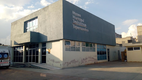
Attractions
Distance to the capital
Distance to the capital (Mexico City) is about — 55 km.