
 Bel-Ha
San Jose El Alto
El Porvenir
Nueva Palestina
Santa Lucía
Chemax
La Morita
Temoac
Zacualpan
Bel-Ha
San Jose El Alto
El Porvenir
Nueva Palestina
Santa Lucía
Chemax
La Morita
Temoac
Zacualpan
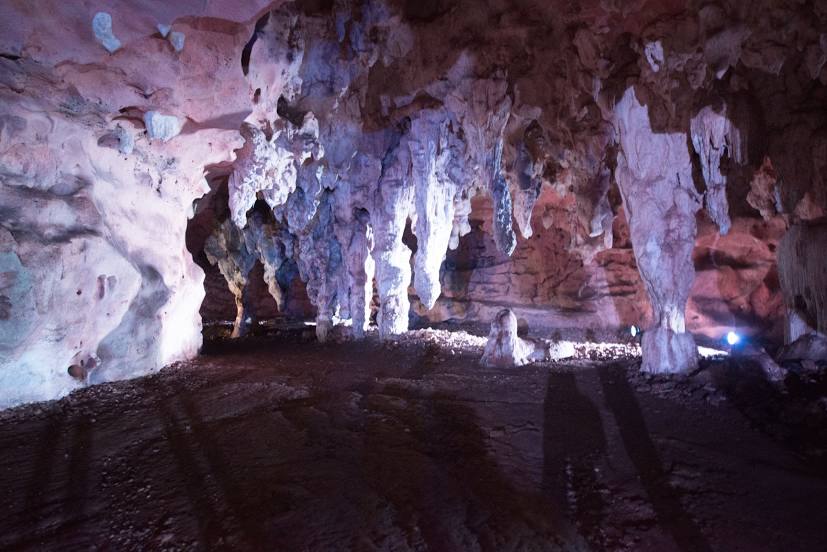
Grottoes Loltún on the map, Oxkutzcab, Mexico
Photo
Where is located Grottoes Loltún
Grottoes Loltún — local attraction, which is located at YUC 31, Yucatán, Mexico and belongs to the category — tourist attraction. Average visitor rating for this place — 4.7 (according to 1936 ratings, information from open sources and relevant for 2022).
Exact location — Grottoes Loltún, marked on the map with a red marker.
You can get directions to Grottoes Loltún on the map from your location.
What else is interesting in Oxkutzcab? You can see all the sights if you go to the city page.
Coordinates
Grottoes Loltún, Mexico coordinates in decimal format: latitude — 20.253283391734065, longitude — -89.45596787553079. When converted to degrees, minutes, seconds Grottoes Loltún has the following coordinates: 20°15′11.82 north latitude and -89°27′21.48 east longitude.
Nearby cities
The largest cities that are located nearby:
- Merida — 76 km
- Campeche — 127 km
- Chetumal — 231 km
- Cancún — 281 km
- Ciudad del Carmen — 310 km
- Villahermosa — 451 km
- San Cristóbal de las Casas — 521 km
- Choloma
 (Honduras) — 543 km
 - San Pedro Sula (Honduras) — 551 km
- Tuxtla Gutiérrez — 553 km
- El Progreso (Honduras) — 569 km
- La Ceiba (Honduras) — 572 km
- Coatzacoalcos — 581 km
- Minatitlán — 597 km
- San Juan Sacatepéquez
 (Guatemala) — 631 km
 - Pinar del Río
 (Cuba) — 632 km
 - Guatemala City (Guatemala) — 640 km
- Quetzaltenango (Guatemala) — 645 km
- Villa Nueva (Guatemala) — 651 km
Distance to the capital
Distance to the capital (Mexico City) is about — 1016 km.