 Warner Robins
Wantagh
Bethel
Misty Hill Farm
United States
Wakonda Beach (R33) Airport
Wilmington
Poland
Miami International Airport
Warner Robins
Wantagh
Bethel
Misty Hill Farm
United States
Wakonda Beach (R33) Airport
Wilmington
Poland
Miami International Airport
Pepper Rock Park on the map, Round Rock, United States
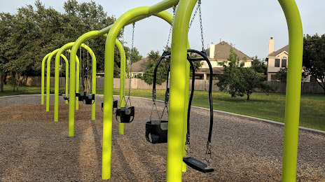
Photo
Where is located Pepper Rock Park
Pepper Rock Park — local attraction, which is located at 8609 Pepper Rock Dr, Austin, TX 78717, United States and belongs to the category — park. Average visitor rating for this place — 4.7 (according to 212 ratings, information from open sources and relevant for 2022).
Exact location — Pepper Rock Park, marked on the map with a red marker.
You can get directions to Pepper Rock Park on the map from your location.
What else is interesting in Round Rock? You can see all the sights if you go to the city page.
Coordinates
Pepper Rock Park, United States coordinates in decimal format: latitude — 30.513201223250253, longitude — -97.70545906189743. When converted to degrees, minutes, seconds Pepper Rock Park has the following coordinates: 30°30′47.52 north latitude and -97°42′19.65 east longitude.
Nearby cities
The largest cities that are located nearby:
- Austin — 27 km
- Killeen — 67 km
- Waco — 126 km
- San Antonio — 143 km
- Houston — 237 km
- Fort Worth — 251 km
- Arlington — 252 km
- Grand Prairie — 255 km
- Irving — 264 km
- Dallas — 264 km
- Mesquite — 269 km
- Carrollton — 282 km
- Garland — 283 km
- Richardson — 284 km
- Abilene — 288 km
- Plano — 292 km
- Corpus Christi — 301 km
- Frisco — 303 km
- Denton — 303 km
Distance to the capital
Distance to the capital (Washington) is about — 2101 km.