 Warner Robins
Wantagh
Bethel
Misty Hill Farm
United States
Wakonda Beach (R33) Airport
Wilmington
Poland
Miami International Airport
Warner Robins
Wantagh
Bethel
Misty Hill Farm
United States
Wakonda Beach (R33) Airport
Wilmington
Poland
Miami International Airport
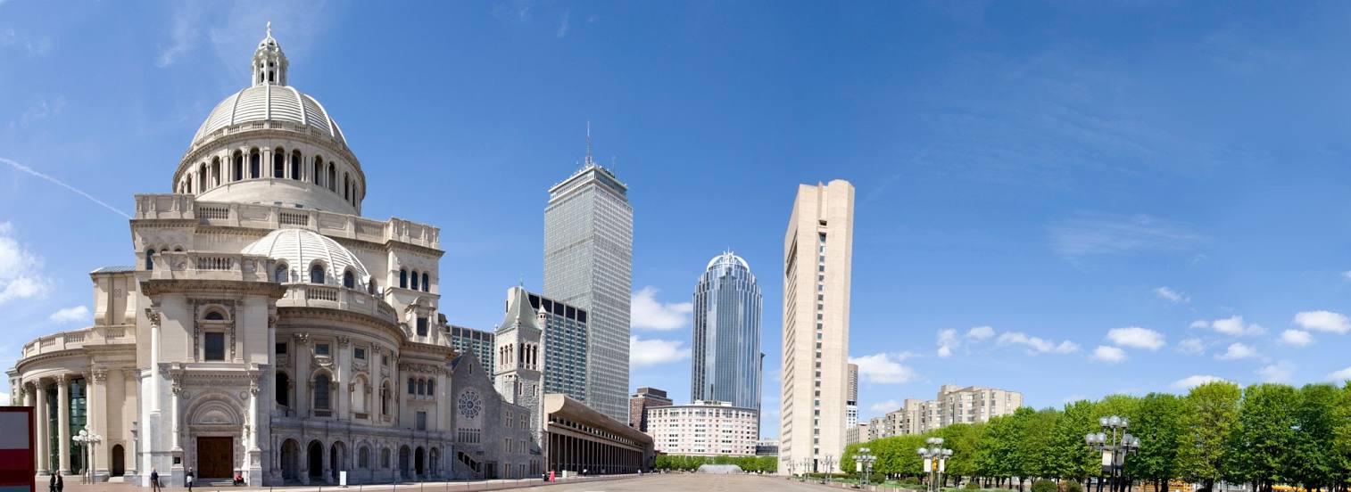
Christian Science Plaza on the map, Boston, United States
Photo
Where is located Christian Science Plaza
Christian Science Plaza — local attraction, which is located at 13.5 acre Plaza at the intersections of Massachusetts Ave, Clearway St Belvidere St, and, Huntington Ave, Boston, MA 02115, United States and belongs to the category — religious organization. Average visitor rating for this place — 4.4 (according to 204 ratings, information from open sources and relevant for 2022).
Exact location — Christian Science Plaza, marked on the map with a red marker.
You can get directions to Christian Science Plaza on the map from your location.
What else is interesting in Boston? You can see all the sights if you go to the city page.
Coordinates
Christian Science Plaza, United States coordinates in decimal format: latitude — 42.3441134950129, longitude — -71.08495727499484. When converted to degrees, minutes, seconds Christian Science Plaza has the following coordinates: 42°20′38.81 north latitude and -71°5′5.85 east longitude.
Nearby cities
The largest cities that are located nearby:
- Cambridge — 4 km
- Lowell — 37 km
- Worcester — 62 km
- Providence — 66 km
- Manchester — 77 km
- Amherst — 118 km
- Springfield — 129 km
- Hartford — 149 km
- Waterbury — 187 km
- New Haven — 194 km
- Bridgeport — 220 km
- Stamford — 252 km
- Yonkers — 285 km
- Paterson — 305 km
- New York — 307 km
- Brooklyn — 307 km
- Newark — 317 km
- Elizabeth — 324 km
- Sherbrooke
 (Canada) — 342 km
Distance to the capital
Distance to the capital (Washington) is about — 631 km.