 Warner Robins
Wantagh
Bethel
Misty Hill Farm
United States
Wakonda Beach (R33) Airport
Wilmington
Poland
Miami International Airport
Warner Robins
Wantagh
Bethel
Misty Hill Farm
United States
Wakonda Beach (R33) Airport
Wilmington
Poland
Miami International Airport
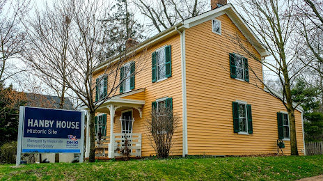
Hanby House on the map, Westerville, United States
Photo
Where is located Hanby House
Hanby House — local attraction, which is located at 160 W Main St, Westerville, OH 43081, United States and belongs to the category — museum. Average visitor rating for this place — 4.7 (according to 11 ratings, information from open sources and relevant for 2022).
Exact location — Hanby House, marked on the map with a red marker.
You can get directions to Hanby House on the map from your location.
What else is interesting in Westerville? You can see all the sights if you go to the city page.
Coordinates
Hanby House, United States coordinates in decimal format: latitude — 40.12613356337555, longitude — -82.93765557506349. When converted to degrees, minutes, seconds Hanby House has the following coordinates: 40°7′34.08 north latitude and -82°56′15.56 east longitude.
Nearby cities
The largest cities that are located nearby:
- Columbus — 19 km
- Springfield — 78 km
- Akron — 158 km
- Cincinnati — 177 km
- Toledo — 178 km
- Cleveland — 183 km
- Aurora — 186 km
- Fort Wayne — 212 km
- Windsor
 (Canada) — 242 km
 - Detroit — 244 km
- Ann Arbor — 247 km
- Pittsburgh — 249 km
- Warren — 264 km
- Sterling Heights — 271 km
- Indianapolis — 277 km
- Lansing — 317 km
- Louisville — 321 km
- South Bend — 324 km
- Flint — 325 km
Distance to the capital
Distance to the capital (Washington) is about — 524 km.