 Warner Robins
Wantagh
Bethel
Misty Hill Farm
United States
Wakonda Beach (R33) Airport
Wilmington
Poland
Miami International Airport
Warner Robins
Wantagh
Bethel
Misty Hill Farm
United States
Wakonda Beach (R33) Airport
Wilmington
Poland
Miami International Airport
Matthew Henson State Park on the map, Silver Spring, United States
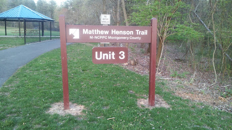
Photo
Where is located Matthew Henson State Park
Matthew Henson State Park — local attraction, which is located at Veirs Mill Road east to, Georgia Ave, Aspen Hill, MD 20906, United States and belongs to the category — county park. Average visitor rating for this place — 4.4 (according to 194 ratings, information from open sources and relevant for 2022).
Exact location — Matthew Henson State Park, marked on the map with a red marker.
You can get directions to Matthew Henson State Park on the map from your location.
What else is interesting in Silver Spring? You can see all the sights if you go to the city page.
Coordinates
Matthew Henson State Park, United States coordinates in decimal format: latitude — 39.075627499269224, longitude — -77.07130177509494. When converted to degrees, minutes, seconds Matthew Henson State Park has the following coordinates: 39°4′32.26 north latitude and -77°4′16.69 east longitude.
Nearby cities
The largest cities that are located nearby:
- Alexandria — 21 km
- Baltimore — 49 km
- Richmond — 164 km
- Philadelphia — 190 km
- Allentown — 220 km
- Hampton — 225 km
- Norfolk — 245 km
- Virginia Beach — 254 km
- Chesapeake — 254 km
- Toms River — 262 km
- Edison — 277 km
- Pittsburgh — 297 km
- Elizabeth — 300 km
- Newark — 307 km
- Brooklyn — 316 km
- New York — 317 km
- Paterson — 320 km
- Yonkers — 338 km
- Stamford — 370 km
Distance to the capital
Distance to the capital (Washington) is about — 19 km.