 Warner Robins
Wantagh
Bethel
Misty Hill Farm
United States
Wakonda Beach (R33) Airport
Wilmington
Poland
Miami International Airport
Warner Robins
Wantagh
Bethel
Misty Hill Farm
United States
Wakonda Beach (R33) Airport
Wilmington
Poland
Miami International Airport
Deerfield Beach International Fishing Pier on the map, Boca Raton, United States
Photo
Where is located Deerfield Beach International Fishing Pier
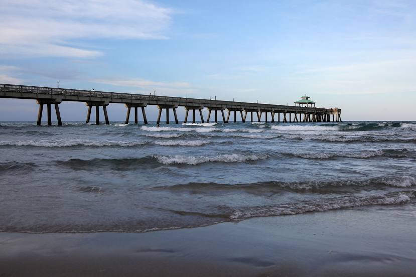
Deerfield Beach International Fishing Pier — local attraction, which is located at 200 NE 21st Ave, Deerfield Beach, FL 33441, United States and belongs to the category — fishing pier. Average visitor rating for this place — 4.7 (according to 2615 ratings, information from open sources and relevant for 2022).
Exact location — Deerfield Beach International Fishing Pier, marked on the map with a red marker.
You can get directions to Deerfield Beach International Fishing Pier on the map from your location.
What else is interesting in Boca Raton? You can see all the sights if you go to the city page.
Coordinates
Deerfield Beach International Fishing Pier, United States coordinates in decimal format: latitude — 26.31640100737027, longitude — -80.07274347541824. When converted to degrees, minutes, seconds Deerfield Beach International Fishing Pier has the following coordinates: 26°18′59.04 north latitude and -80°4′21.88 east longitude.
Nearby cities
The largest cities that are located nearby:
- Coral Springs — 18 km
- Fort Lauderdale — 27 km
- Hollywood — 40 km
- Pembroke Pines — 43 km
- Miramar — 46 km
- Hialeah — 58 km
- Miami — 67 km
- Port Saint Lucie — 103 km
- Cape Coral — 181 km
- Orlando — 269 km
- Brandon — 273 km
- Tampa — 287 km
- Saint Petersburg — 291 km
- Nassau
 (The Bahamas) — 314 km
 - Clearwater — 315 km
- Matanzas
 (Cuba) — 396 km
 - Havana (Cuba) — 416 km
- Gainesville — 420 km
- Santa Clara (Cuba) — 436 km
Distance to the capital
Distance to the capital (Washington) is about — 1429 km.