 Warner Robins
Wantagh
Bethel
Misty Hill Farm
United States
Wakonda Beach (R33) Airport
Wilmington
Poland
Miami International Airport
Warner Robins
Wantagh
Bethel
Misty Hill Farm
United States
Wakonda Beach (R33) Airport
Wilmington
Poland
Miami International Airport
Black Creek Marsh Wildlife Management Area on the map, Albany, United States
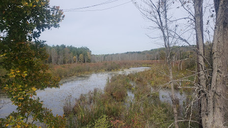
Photo
Where is located Black Creek Marsh Wildlife Management Area
Black Creek Marsh Wildlife Management Area — local attraction, which is located at Voorheesville, NY 12186, United States and belongs to the category — park. Average visitor rating for this place — 4.0 (according to 6 ratings, information from open sources and relevant for 2022).
Exact location — Black Creek Marsh Wildlife Management Area, marked on the map with a red marker.
You can get directions to Black Creek Marsh Wildlife Management Area on the map from your location.
What else is interesting in Albany? You can see all the sights if you go to the city page.
Coordinates
Black Creek Marsh Wildlife Management Area, United States coordinates in decimal format: latitude — 42.66235227617062, longitude — -73.93975317498472. When converted to degrees, minutes, seconds Black Creek Marsh Wildlife Management Area has the following coordinates: 42°39′44.47 north latitude and -73°56′23.11 east longitude.
Nearby cities
The largest cities that are located nearby:
- Amherst — 109 km
- Springfield — 113 km
- Hartford — 132 km
- Waterbury — 134 km
- New Haven — 164 km
- Worcester — 166 km
- Bridgeport — 169 km
- Stamford — 178 km
- Manchester — 190 km
- Yonkers — 191 km
- Paterson — 195 km
- Syracuse — 198 km
- Lowell — 198 km
- Providence — 214 km
- Newark — 215 km
- New York — 215 km
- Brooklyn — 217 km
- Cambridge — 218 km
- Boston — 223 km
Distance to the capital
Distance to the capital (Washington) is about — 492 km.