 Warner Robins
Wantagh
Bethel
Misty Hill Farm
United States
Wakonda Beach (R33) Airport
Wilmington
Poland
Miami International Airport
Warner Robins
Wantagh
Bethel
Misty Hill Farm
United States
Wakonda Beach (R33) Airport
Wilmington
Poland
Miami International Airport
Pickerington Ponds Metro Park on the map, Columbus, United States
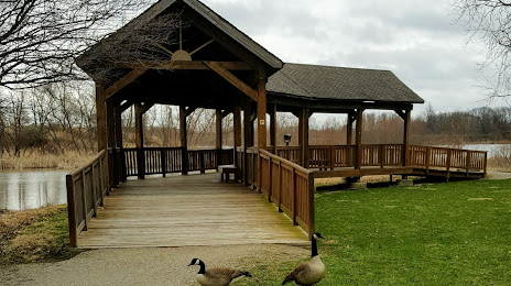
Photo
Where is located Pickerington Ponds Metro Park
Pickerington Ponds Metro Park — local attraction, which is located at 7680 Wright Rd, Canal Winchester, OH 43110, United States and belongs to the category — park. Average visitor rating for this place — 4.5 (according to 636 ratings, information from open sources and relevant for 2022).
Exact location — Pickerington Ponds Metro Park, marked on the map with a red marker.
You can get directions to Pickerington Ponds Metro Park on the map from your location.
What else is interesting in Columbus? You can see all the sights if you go to the city page.
Coordinates
Pickerington Ponds Metro Park, United States coordinates in decimal format: latitude — 39.886346633511195, longitude — -82.80487307507069. When converted to degrees, minutes, seconds Pickerington Ponds Metro Park has the following coordinates: 39°53′10.85 north latitude and -82°48′17.54 east longitude.
Nearby cities
The largest cities that are located nearby:
- Springfield — 69 km
- Cincinnati — 161 km
- Akron — 175 km
- Toledo — 194 km
- Cleveland — 201 km
- Aurora — 203 km
- Fort Wayne — 217 km
- Pittsburgh — 258 km
- Windsor
 (Canada) — 260 km
 - Detroit — 262 km
- Ann Arbor — 264 km
- Indianapolis — 269 km
- Warren — 282 km
- Sterling Heights — 290 km
- Louisville — 305 km
- South Bend — 329 km
- Lansing — 331 km
- Flint — 342 km
- London (Canada) — 363 km
Distance to the capital
Distance to the capital (Washington) is about — 507 km.