 Warner Robins
Wantagh
Bethel
Misty Hill Farm
United States
Wakonda Beach (R33) Airport
Wilmington
Poland
Miami International Airport
Warner Robins
Wantagh
Bethel
Misty Hill Farm
United States
Wakonda Beach (R33) Airport
Wilmington
Poland
Miami International Airport
Coldwater Spring on the map, Saint Paul, United States
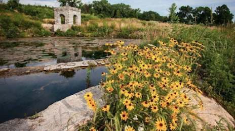
Photo
Where is located Coldwater Spring
Coldwater Spring — local attraction, which is located at 5601 Minnehaha Park Dr S, St Paul, MN 55111, United States and belongs to the category — state park. Average visitor rating for this place — 4.7 (according to 208 ratings, information from open sources and relevant for 2022).
Exact location — Coldwater Spring, marked on the map with a red marker.
You can get directions to Coldwater Spring on the map from your location.
What else is interesting in Saint Paul? You can see all the sights if you go to the city page.
Coordinates
Coldwater Spring, United States coordinates in decimal format: latitude — 44.901278481390634, longitude — -93.19752707491189. When converted to degrees, minutes, seconds Coldwater Spring has the following coordinates: 44°54′4.6 north latitude and -93°11′51.1 east longitude.
Nearby cities
The largest cities that are located nearby:
- Minneapolis — 14 km
- Sioux Falls — 331 km
- Madison — 363 km
- Des Moines — 373 km
- Green Bay — 403 km
- Rockford — 441 km
- Milwaukee — 469 km
- Omaha — 475 km
- Aurora — 529 km
- Naperville — 540 km
- Lincoln — 547 km
- Peoria — 555 km
- Joliet — 562 km
- Chicago — 564 km
- Winnipeg
 (Canada) — 618 km
 - Grand Rapids — 640 km
- North Kansas City — 655 km
- Independence — 658 km
- Kansas City — 660 km
Distance to the capital
Distance to the capital (Washington) is about — 1491 km.