 Warner Robins
Wantagh
Bethel
Misty Hill Farm
United States
Wakonda Beach (R33) Airport
Wilmington
Poland
Miami International Airport
Warner Robins
Wantagh
Bethel
Misty Hill Farm
United States
Wakonda Beach (R33) Airport
Wilmington
Poland
Miami International Airport
Karst Farm Park on the map, Bloomington, United States
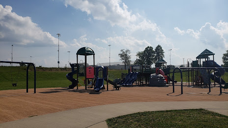
Photo
Where is located Karst Farm Park
Karst Farm Park — local attraction, which is located at 2450 S Endwright Rd, Bloomington, IN 47403, United States and belongs to the category — park. Average visitor rating for this place — 4.6 (according to 442 ratings, information from open sources and relevant for 2022).
Exact location — Karst Farm Park, marked on the map with a red marker.
You can get directions to Karst Farm Park on the map from your location.
What else is interesting in Bloomington? You can see all the sights if you go to the city page.
Coordinates
Karst Farm Park, United States coordinates in decimal format: latitude — 39.13934883312879, longitude — -86.59877117509308. When converted to degrees, minutes, seconds Karst Farm Park has the following coordinates: 39°8′21.66 north latitude and -86°35′55.58 east longitude.
Nearby cities
The largest cities that are located nearby:
- Indianapolis — 74 km
- Louisville — 121 km
- Evansville — 160 km
- Cincinnati — 173 km
- Fort Wayne — 241 km
- Springfield — 245 km
- South Bend — 279 km
- Joliet — 291 km
- Clarksville — 301 km
- Peoria — 307 km
- Columbus — 312 km
- Chicago — 313 km
- Naperville — 316 km
- Saint Louis — 323 km
- Aurora — 323 km
- Nashville — 333 km
- Toledo — 370 km
- Rockford — 403 km
- Ann Arbor — 413 km
Distance to the capital
Distance to the capital (Washington) is about — 826 km.