 Warner Robins
Wantagh
Bethel
Misty Hill Farm
United States
Wakonda Beach (R33) Airport
Wilmington
Poland
Miami International Airport
Warner Robins
Wantagh
Bethel
Misty Hill Farm
United States
Wakonda Beach (R33) Airport
Wilmington
Poland
Miami International Airport
Streatorland Historical Museum on the map, Streator, United States
Photo
Where is located Streatorland Historical Museum
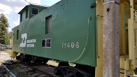
Streatorland Historical Museum — local attraction, which is located at 306 S Vermillion St, Streator, IL 61364, United States and belongs to the category — museum. Average visitor rating for this place — 4.9 (according to 22 ratings, information from open sources and relevant for 2022).
Exact location — Streatorland Historical Museum, marked on the map with a red marker.
You can get directions to Streatorland Historical Museum on the map from your location.
What else is interesting in Streator? You can see all the sights if you go to the city page.
Coordinates
Streatorland Historical Museum, United States coordinates in decimal format: latitude — 41.117357707055874, longitude — -88.83177157503316. When converted to degrees, minutes, seconds Streatorland Historical Museum has the following coordinates: 41°7′2.49 north latitude and -88°49′54.38 east longitude.
Nearby cities
The largest cities that are located nearby:
- Joliet — 77 km
- Peoria — 79 km
- Aurora — 83 km
- Naperville — 90 km
- Rockford — 129 km
- Chicago — 130 km
- Madison — 221 km
- South Bend — 222 km
- Milwaukee — 225 km
- Indianapolis — 272 km
- Saint Louis — 300 km
- Fort Wayne — 308 km
- Grand Rapids — 327 km
- Evansville — 365 km
- Green Bay — 381 km
- Lansing — 391 km
- Des Moines — 398 km
- Louisville — 415 km
- Cincinnati — 433 km
Distance to the capital
Distance to the capital (Washington) is about — 1034 km.