 Warner Robins
Wantagh
Bethel
Misty Hill Farm
United States
Wakonda Beach (R33) Airport
Wilmington
Poland
Miami International Airport
Warner Robins
Wantagh
Bethel
Misty Hill Farm
United States
Wakonda Beach (R33) Airport
Wilmington
Poland
Miami International Airport
Friendship Park on the map, Gahanna, United States
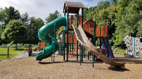
Photo
Where is located Friendship Park
Friendship Park — local attraction, which is located at 150 Oklahoma Ave, Gahanna, OH 43230, United States and belongs to the category — park. Average visitor rating for this place — 4.6 (according to 535 ratings, information from open sources and relevant for 2022).
Exact location — Friendship Park, marked on the map with a red marker.
You can get directions to Friendship Park on the map from your location.
What else is interesting in Gahanna? You can see all the sights if you go to the city page.
Coordinates
Friendship Park, United States coordinates in decimal format: latitude — 40.01466740292665, longitude — -82.8757288750669. When converted to degrees, minutes, seconds Friendship Park has the following coordinates: 40°0′52.8 north latitude and -82°52′32.62 east longitude.
Nearby cities
The largest cities that are located nearby:
- Columbus — 12 km
- Springfield — 80 km
- Akron — 163 km
- Cincinnati — 173 km
- Toledo — 190 km
- Cleveland — 191 km
- Aurora — 192 km
- Fort Wayne — 222 km
- Pittsburgh — 247 km
- Windsor
 (Canada) — 254 km
 - Detroit — 256 km
- Ann Arbor — 260 km
- Warren — 276 km
- Indianapolis — 280 km
- Sterling Heights — 283 km
- Louisville — 317 km
- Lansing — 329 km
- South Bend — 333 km
- Flint — 337 km
Distance to the capital
Distance to the capital (Washington) is about — 516 km.