 Warner Robins
Wantagh
Bethel
Misty Hill Farm
United States
Wakonda Beach (R33) Airport
Wilmington
Poland
Miami International Airport
Warner Robins
Wantagh
Bethel
Misty Hill Farm
United States
Wakonda Beach (R33) Airport
Wilmington
Poland
Miami International Airport
National Airline History Museum on the map, Kansas City, United States
Photo
Where is located National Airline History Museum
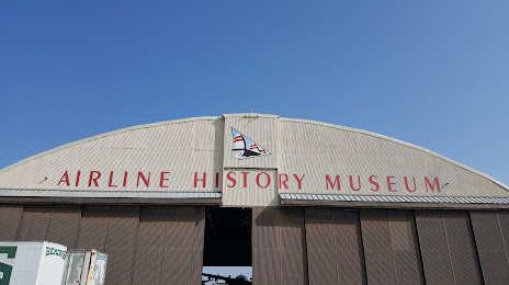
National Airline History Museum — local attraction, which is located at 201 NW Lou Holland Dr, Kansas City, MO 64116, United States and belongs to the category — museum. Average visitor rating for this place — 4.3 (according to 171 rating, information from open sources and relevant for 2022).
Exact location — National Airline History Museum, marked on the map with a red marker.
You can get directions to National Airline History Museum on the map from your location.
What else is interesting in Kansas City? You can see all the sights if you go to the city page.
Coordinates
National Airline History Museum, United States coordinates in decimal format: latitude — 39.118675922138685, longitude — -94.60041007509368. When converted to degrees, minutes, seconds National Airline History Museum has the following coordinates: 39°7′7.23 north latitude and -94°36′1.48 east longitude.
Nearby cities
The largest cities that are located nearby:
- North Kansas City — 5 km
- Independence — 14 km
- Overland Park — 15 km
- Olathe — 32 km
- Topeka — 95 km
- Springfield — 238 km
- Lincoln — 260 km
- Omaha — 266 km
- Wichita — 287 km
- Des Moines — 288 km
- Tulsa — 349 km
- Saint Louis — 382 km
- Peoria — 454 km
- Oklahoma City — 481 km
- Norman — 501 km
- Sioux Falls — 521 km
- Little Rock — 524 km
- Rockford — 569 km
- Aurora — 594 km
Distance to the capital
Distance to the capital (Washington) is about — 1516 km.