 Warner Robins
Wantagh
Bethel
Misty Hill Farm
United States
Wakonda Beach (R33) Airport
Wilmington
Poland
Miami International Airport
Warner Robins
Wantagh
Bethel
Misty Hill Farm
United States
Wakonda Beach (R33) Airport
Wilmington
Poland
Miami International Airport
McAdams Park on the map, Hobbs, United States
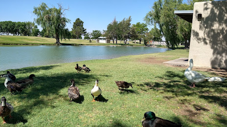
Photo
Where is located McAdams Park
McAdams Park — local attraction, which is located at 5300 Jack Gomez Blvd, Hobbs, NM 88240, United States and belongs to the category — park. Average visitor rating for this place — 4.5 (according to 251 rating, information from open sources and relevant for 2022).
Exact location — McAdams Park, marked on the map with a red marker.
You can get directions to McAdams Park on the map from your location.
What else is interesting in Hobbs? You can see all the sights if you go to the city page.
Coordinates
McAdams Park, United States coordinates in decimal format: latitude — 32.772863986245426, longitude — -103.20443747526863. When converted to degrees, minutes, seconds McAdams Park has the following coordinates: 32°46′22.31 north latitude and -103°12′15.97 east longitude.
Nearby cities
The largest cities that are located nearby:
- Lubbock — 153 km
- Amarillo — 302 km
- Abilene — 319 km
- El Paso — 327 km
- Ciudad Juarez
 (Mexico) — 329 km
 - Valencia — 398 km
- Albuquerque — 410 km
- Ciudad Acuna (Mexico) — 429 km
- Wichita Falls — 447 km
- Piedras Negras (Mexico) — 510 km
- Chihuahua (Mexico) — 532 km
- Fort Worth — 540 km
- Killeen — 541 km
- Delicias (Mexico) — 548 km
- Denton — 558 km
- Arlington — 561 km
- Grand Prairie — 571 km
- Irving — 575 km
- San Antonio — 576 km
Distance to the capital
Distance to the capital (Washington) is about — 2446 km.