 Warner Robins
Wantagh
Bethel
Misty Hill Farm
United States
Wakonda Beach (R33) Airport
Wilmington
Poland
Miami International Airport
Warner Robins
Wantagh
Bethel
Misty Hill Farm
United States
Wakonda Beach (R33) Airport
Wilmington
Poland
Miami International Airport
Memorial Park on the map, Bentonville, United States
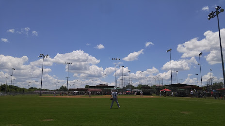
Photo
Where is located Memorial Park
Memorial Park — local attraction, which is located at 401 NE Martin Luther King Jr Pkwy, Bentonville, AR 72712, United States and belongs to the category — memorial park. Average visitor rating for this place — 4.6 (according to 632 ratings, information from open sources and relevant for 2022).
Exact location — Memorial Park, marked on the map with a red marker.
You can get directions to Memorial Park on the map from your location.
What else is interesting in Bentonville? You can see all the sights if you go to the city page.
Coordinates
Memorial Park, United States coordinates in decimal format: latitude — 36.374070207005886, longitude — -94.18784327517263. When converted to degrees, minutes, seconds Memorial Park has the following coordinates: 36°22′26.65 north latitude and -94°11′16.24 east longitude.
Nearby cities
The largest cities that are located nearby:
- Springfield — 123 km
- Tulsa — 161 km
- Little Rock — 250 km
- Olathe — 282 km
- Overland Park — 291 km
- Independence — 301 km
- Kansas City — 303 km
- North Kansas City — 308 km
- Wichita — 310 km
- Oklahoma City — 314 km
- Norman — 318 km
- Topeka — 323 km
- Memphis — 400 km
- Saint Louis — 427 km
- Shreveport — 428 km
- Frisco — 431 km
- Plano — 437 km
- Denton — 442 km
- Garland — 444 km
Distance to the capital
Distance to the capital (Washington) is about — 1534 km.