 Warner Robins
Wantagh
Bethel
Misty Hill Farm
United States
Wakonda Beach (R33) Airport
Wilmington
Poland
Miami International Airport
Warner Robins
Wantagh
Bethel
Misty Hill Farm
United States
Wakonda Beach (R33) Airport
Wilmington
Poland
Miami International Airport
Cape Coral Yacht Club Park Fishing Pier on the map, Cape Coral, United States
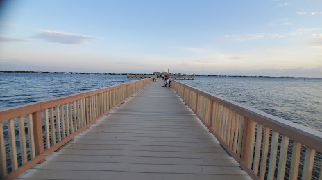
Photo
Where is located Cape Coral Yacht Club Park Fishing Pier
Cape Coral Yacht Club Park Fishing Pier — local attraction, which is located at 5819 Driftwood Pkwy, Cape Coral, FL 33904, United States and belongs to the category — fishing pier. Average visitor rating for this place — 4.7 (according to 148 ratings, information from open sources and relevant for 2022).
Exact location — Cape Coral Yacht Club Park Fishing Pier, marked on the map with a red marker.
You can get directions to Cape Coral Yacht Club Park Fishing Pier on the map from your location.
What else is interesting in Cape Coral? You can see all the sights if you go to the city page.
Coordinates
Cape Coral Yacht Club Park Fishing Pier, United States coordinates in decimal format: latitude — 26.540179591197788, longitude — -81.95053617541346. When converted to degrees, minutes, seconds Cape Coral Yacht Club Park Fishing Pier has the following coordinates: 26°32′24.65 north latitude and -81°57′1.93 east longitude.
Nearby cities
The largest cities that are located nearby:
- Saint Petersburg — 150 km
- Brandon — 156 km
- Tampa — 161 km
- Coral Springs — 170 km
- Port Saint Lucie — 175 km
- Pembroke Pines — 175 km
- Miramar — 176 km
- Clearwater — 176 km
- Hialeah — 184 km
- Fort Lauderdale — 186 km
- Hollywood — 189 km
- Miami — 196 km
- Orlando — 225 km
- Gainesville — 343 km
- Havana
 (Cuba) — 378 km
 - Matanzas (Cuba) — 393 km
- Jacksonville — 418 km
- Tallahassee — 483 km
- Nassau
 (The Bahamas) — 490 km
Distance to the capital
Distance to the capital (Washington) is about — 1450 km.