 Warner Robins
Wantagh
Bethel
Misty Hill Farm
United States
Wakonda Beach (R33) Airport
Wilmington
Poland
Miami International Airport
Warner Robins
Wantagh
Bethel
Misty Hill Farm
United States
Wakonda Beach (R33) Airport
Wilmington
Poland
Miami International Airport
Kankakee Valley Park District on the map, Kankakee, United States
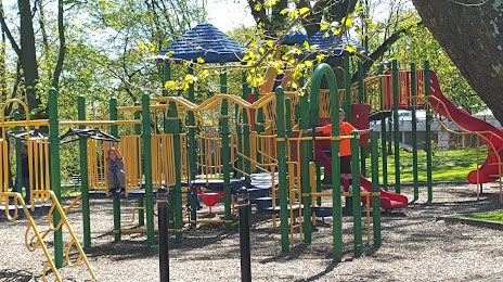
Photo
Where is located Kankakee Valley Park District
Kankakee Valley Park District — local attraction, which is located at 893 W Station St, Kankakee, IL 60901, United States and belongs to the category — park. Average visitor rating for this place — 4.3 (according to 61 rating, information from open sources and relevant for 2022).
Exact location — Kankakee Valley Park District, marked on the map with a red marker.
You can get directions to Kankakee Valley Park District on the map from your location.
What else is interesting in Kankakee? You can see all the sights if you go to the city page.
Coordinates
Kankakee Valley Park District, United States coordinates in decimal format: latitude — 41.120857408994794, longitude — -87.87888167503306. When converted to degrees, minutes, seconds Kankakee Valley Park District has the following coordinates: 41°7′15.09 north latitude and -87°52′43.97 east longitude.
Nearby cities
The largest cities that are located nearby:
- Joliet — 48 km
- Naperville — 74 km
- Aurora — 80 km
- Chicago — 86 km
- South Bend — 146 km
- Peoria — 152 km
- Rockford — 162 km
- Indianapolis — 208 km
- Milwaukee — 212 km
- Fort Wayne — 227 km
- Madison — 249 km
- Grand Rapids — 270 km
- Lansing — 322 km
- Saint Louis — 342 km
- Evansville — 349 km
- Ann Arbor — 360 km
- Toledo — 361 km
- Cincinnati — 364 km
- Louisville — 366 km
Distance to the capital
Distance to the capital (Washington) is about — 955 km.