 Warner Robins
Wantagh
Bethel
Misty Hill Farm
United States
Wakonda Beach (R33) Airport
Wilmington
Poland
Miami International Airport
Warner Robins
Wantagh
Bethel
Misty Hill Farm
United States
Wakonda Beach (R33) Airport
Wilmington
Poland
Miami International Airport
Cypress Creek Natural Area on the map, Palm Beach Gardens, United States
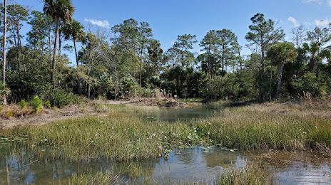
Photo
Where is located Cypress Creek Natural Area
Cypress Creek Natural Area — local attraction, which is located at 10035 W Indiantown Rd, Jupiter, FL 33478, United States and belongs to the category — nature preserve. Average visitor rating for this place — 4.4 (according to 180 ratings, information from open sources and relevant for 2022).
Exact location — Cypress Creek Natural Area, marked on the map with a red marker.
You can get directions to Cypress Creek Natural Area on the map from your location.
What else is interesting in Palm Beach Gardens? You can see all the sights if you go to the city page.
Coordinates
Cypress Creek Natural Area, United States coordinates in decimal format: latitude — 26.9424705435544, longitude — -80.191663975405. When converted to degrees, minutes, seconds Cypress Creek Natural Area has the following coordinates: 26°56′32.89 north latitude and -80°11′29.99 east longitude.
Nearby cities
The largest cities that are located nearby:
- Port Saint Lucie — 54 km
- Coral Springs — 62 km
- Fort Lauderdale — 77 km
- Hollywood — 90 km
- Pembroke Pines — 92 km
- Miramar — 94 km
- Hialeah — 108 km
- Miami — 118 km
- Cape Coral — 181 km
- Orlando — 225 km
- Brandon — 243 km
- Tampa — 258 km
- Saint Petersburg — 266 km
- Clearwater — 289 km
- Nassau
 (The Bahamas) — 341 km
 - Gainesville — 377 km
- Jacksonville — 414 km
- Matanzas
 (Cuba) — 443 km
 - Havana (Cuba) — 459 km
Distance to the capital
Distance to the capital (Washington) is about — 1363 km.