 Warner Robins
Wantagh
Bethel
Misty Hill Farm
United States
Wakonda Beach (R33) Airport
Wilmington
Poland
Miami International Airport
Warner Robins
Wantagh
Bethel
Misty Hill Farm
United States
Wakonda Beach (R33) Airport
Wilmington
Poland
Miami International Airport
Overmountain Victory National Historic Trail on the map, Kings Mountain, United States
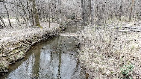
Photo
Where is located Overmountain Victory National Historic Trail
Overmountain Victory National Historic Trail — local attraction, which is located at 2635 Park Rd, Blacksburg, SC 29702, United States and belongs to the category — hiking area. Average visitor rating for this place — 5.0 (according to 3 ratings, information from open sources and relevant for 2022).
Exact location — Overmountain Victory National Historic Trail, marked on the map with a red marker.
You can get directions to Overmountain Victory National Historic Trail on the map from your location.
What else is interesting in Kings Mountain? You can see all the sights if you go to the city page.
Coordinates
Overmountain Victory National Historic Trail, United States coordinates in decimal format: latitude — 35.141837900542036, longitude — -81.34495097520643. When converted to degrees, minutes, seconds Overmountain Victory National Historic Trail has the following coordinates: 35°8′30.62 north latitude and -81°20′41.82 east longitude.
Nearby cities
The largest cities that are located nearby:
- Charlotte — 45 km
- Winston-Salem — 136 km
- Columbia — 140 km
- Greensboro — 166 km
- Fayetteville — 224 km
- Durham — 234 km
- Cary — 237 km
- Knoxville — 244 km
- Raleigh — 250 km
- Charleston — 303 km
- Atlanta — 325 km
- Savannah — 350 km
- Chattanooga — 360 km
- Richmond — 426 km
- Chesapeake — 478 km
- Huntsville — 480 km
- Norfolk — 481 km
- Hampton — 483 km
- Nashville — 496 km
Distance to the capital
Distance to the capital (Washington) is about — 567 km.