 Warner Robins
Wantagh
Bethel
Misty Hill Farm
United States
Wakonda Beach (R33) Airport
Wilmington
Poland
Miami International Airport
Warner Robins
Wantagh
Bethel
Misty Hill Farm
United States
Wakonda Beach (R33) Airport
Wilmington
Poland
Miami International Airport
Broken Arrow Lanes on the map, Broken Arrow, United States
Photo
Where is located Broken Arrow Lanes
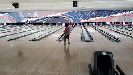
Broken Arrow Lanes — local attraction, which is located at 4701 S Elm Pl, Broken Arrow, OK 74011, United States and belongs to the category — bowling alley. Average visitor rating for this place — 4.3 (according to 647 ratings, information from open sources and relevant for 2022).
Exact location — Broken Arrow Lanes, marked on the map with a red marker.
You can get directions to Broken Arrow Lanes on the map from your location.
What else is interesting in Broken Arrow? You can see all the sights if you go to the city page.
Coordinates
Broken Arrow Lanes, United States coordinates in decimal format: latitude — 36.01590075747619, longitude — -95.71175878032778. When converted to degrees, minutes, seconds Broken Arrow Lanes has the following coordinates: 36°0′57.24 north latitude and -95°42′42.33 east longitude.
Nearby cities
The largest cities that are located nearby:
- Tulsa — 20 km
- Oklahoma City — 168 km
- Norman — 175 km
- Wichita — 225 km
- Springfield — 255 km
- Olathe — 323 km
- Topeka — 331 km
- Frisco — 335 km
- Overland Park — 337 km
- Denton — 338 km
- Wichita Falls — 343 km
- Plano — 346 km
- Little Rock — 350 km
- Kansas City — 352 km
- Richardson — 355 km
- Independence — 355 km
- Carrollton — 356 km
- North Kansas City — 357 km
- Garland — 357 km
Distance to the capital
Distance to the capital (Washington) is about — 1677 km.