 Warner Robins
Wantagh
Bethel
Misty Hill Farm
United States
Wakonda Beach (R33) Airport
Wilmington
Poland
Miami International Airport
Warner Robins
Wantagh
Bethel
Misty Hill Farm
United States
Wakonda Beach (R33) Airport
Wilmington
Poland
Miami International Airport
The Science Center on the map, Carbondale, United States
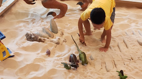
Photo
Where is located The Science Center
The Science Center — local attraction, which is located at 1237 E Main St, Carbondale, IL 62901, United States and belongs to the category — museum. Average visitor rating for this place — 4.5 (according to 151 rating, information from open sources and relevant for 2022).
Exact location — The Science Center, marked on the map with a red marker.
You can get directions to The Science Center on the map from your location.
What else is interesting in Carbondale? You can see all the sights if you go to the city page.
Coordinates
The Science Center, United States coordinates in decimal format: latitude — 37.72835179430871, longitude — -89.19376317513428. When converted to degrees, minutes, seconds The Science Center has the following coordinates: 37°43′42.07 north latitude and -89°11′37.55 east longitude.
Nearby cities
The largest cities that are located nearby:
- Saint Louis — 131 km
- Evansville — 146 km
- Clarksville — 212 km
- Nashville — 278 km
- Memphis — 295 km
- Louisville — 306 km
- Peoria — 329 km
- Indianapolis — 344 km
- Springfield — 363 km
- Huntsville — 409 km
- Joliet — 430 km
- Cincinnati — 431 km
- Little Rock — 432 km
- Aurora — 452 km
- Naperville — 453 km
- Chattanooga — 461 km
- Independence — 471 km
- Chicago — 477 km
- Kansas City — 484 km
Distance to the capital
Distance to the capital (Washington) is about — 1068 km.