 Warner Robins
Wantagh
Bethel
Misty Hill Farm
United States
Wakonda Beach (R33) Airport
Wilmington
Poland
Miami International Airport
Warner Robins
Wantagh
Bethel
Misty Hill Farm
United States
Wakonda Beach (R33) Airport
Wilmington
Poland
Miami International Airport
Armitage Park on the map, Eugene, United States
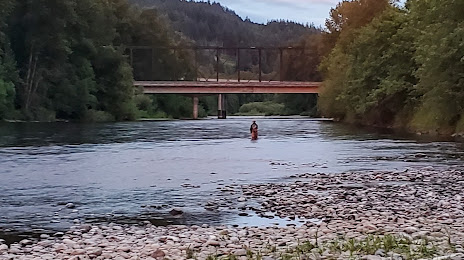
Photo
Where is located Armitage Park
Armitage Park — local attraction, which is located at 90064 Coburg Rd, Eugene, OR 97408, United States and belongs to the category — park. Average visitor rating for this place — 4.4 (according to 386 ratings, information from open sources and relevant for 2022).
Exact location — Armitage Park, marked on the map with a red marker.
You can get directions to Armitage Park on the map from your location.
What else is interesting in Eugene? You can see all the sights if you go to the city page.
Coordinates
Armitage Park, United States coordinates in decimal format: latitude — 44.111244714746704, longitude — -123.05128447493802. When converted to degrees, minutes, seconds Armitage Park has the following coordinates: 44°6′40.48 north latitude and -123°3′4.62 east longitude.
Nearby cities
The largest cities that are located nearby:
- Salem — 99 km
- Portland — 166 km
- Vancouver — 178 km
- Tacoma — 357 km
- Seattle — 397 km
- Bellevue — 399 km
- Victoria
 (Canada) — 484 km
 - Boise — 552 km
- Abbotsford (Canada) — 556 km
- Delta (Canada) — 558 km
- Richmond (Canada) — 565 km
- Surrey (Canada) — 568 km
- Reno — 573 km
- Burnaby (Canada) — 577 km
- Coquitlam (Canada) — 579 km
- Spokane — 580 km
- Anmore (Canada) — 582 km
- Roseville — 606 km
- Sacramento — 620 km
Distance to the capital
Distance to the capital (Washington) is about — 3825 km.