 Warner Robins
Wantagh
Bethel
Misty Hill Farm
United States
Wakonda Beach (R33) Airport
Wilmington
Poland
Miami International Airport
Warner Robins
Wantagh
Bethel
Misty Hill Farm
United States
Wakonda Beach (R33) Airport
Wilmington
Poland
Miami International Airport
Shrader-Weaver Woods on the map, Connersville, United States
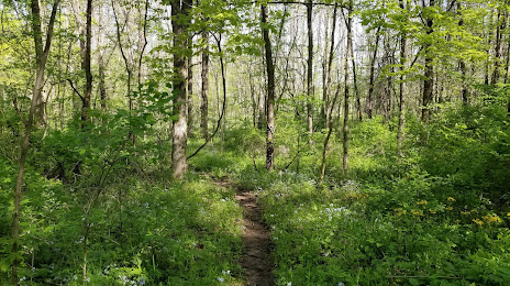
Photo
Where is located Shrader-Weaver Woods
Shrader-Weaver Woods — local attraction, which is located at 5299 N County Rd 450 W, Connersville, IN 47331, United States and belongs to the category — nature preserve. Average visitor rating for this place — 4.9 (according to 22 ratings, information from open sources and relevant for 2022).
Exact location — Shrader-Weaver Woods, marked on the map with a red marker.
You can get directions to Shrader-Weaver Woods on the map from your location.
What else is interesting in Connersville? You can see all the sights if you go to the city page.
Coordinates
Shrader-Weaver Woods, United States coordinates in decimal format: latitude — 39.719809843700354, longitude — -85.22230337507573. When converted to degrees, minutes, seconds Shrader-Weaver Woods has the following coordinates: 39°43′11.32 north latitude and -85°13′20.29 east longitude.
Nearby cities
The largest cities that are located nearby:
- Cincinnati — 80 km
- Indianapolis — 88 km
- Springfield — 117 km
- Fort Wayne — 159 km
- Louisville — 163 km
- Columbus — 185 km
- South Bend — 243 km
- Toledo — 259 km
- Evansville — 281 km
- Ann Arbor — 313 km
- Joliet — 320 km
- Chicago — 321 km
- Naperville — 341 km
- Akron — 341 km
- Windsor
 (Canada) — 342 km
 - Detroit — 343 km
- Lansing — 345 km
- Aurora — 352 km
- Cleveland — 352 km
Distance to the capital
Distance to the capital (Washington) is about — 710 km.