 Warner Robins
Wantagh
Bethel
Misty Hill Farm
United States
Wakonda Beach (R33) Airport
Wilmington
Poland
Miami International Airport
Warner Robins
Wantagh
Bethel
Misty Hill Farm
United States
Wakonda Beach (R33) Airport
Wilmington
Poland
Miami International Airport
North End Beaches on the map, Virginia Beach, United States
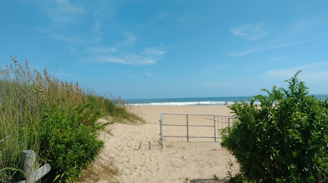
Photo
Where is located North End Beaches
North End Beaches — local attraction, which is located at no data and belongs to the category — -. Average visitor rating for this place — 4.9 (according to 109 ratings, information from open sources and relevant for 2022).
Exact location — North End Beaches, marked on the map with a red marker.
You can get directions to North End Beaches on the map from your location.
What else is interesting in Virginia Beach? You can see all the sights if you go to the city page.
Coordinates
North End Beaches, United States coordinates in decimal format: latitude — 36.891407962667046, longitude — -75.98592567172439. When converted to degrees, minutes, seconds North End Beaches has the following coordinates: 36°53′29.07 north latitude and -75°59′9.33 east longitude.
Nearby cities
The largest cities that are located nearby:
- Norfolk — 27 km
- Chesapeake — 29 km
- Hampton — 38 km
- Richmond — 149 km
- Alexandria — 235 km
- Raleigh — 266 km
- Baltimore — 275 km
- Cary — 277 km
- Durham — 278 km
- Fayetteville — 329 km
- Philadelphia — 350 km
- Greensboro — 352 km
- Toms River — 375 km
- Winston-Salem — 390 km
- Allentown — 417 km
- Edison — 426 km
- Elizabeth — 447 km
- Newark — 455 km
- Brooklyn — 456 km
Distance to the capital
Distance to the capital (Washington) is about — 242 km.