 Warner Robins
Wantagh
Bethel
Misty Hill Farm
United States
Wakonda Beach (R33) Airport
Wilmington
Poland
Miami International Airport
Warner Robins
Wantagh
Bethel
Misty Hill Farm
United States
Wakonda Beach (R33) Airport
Wilmington
Poland
Miami International Airport
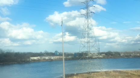
Grand Calumet River on the map, Hammond, United States
Photo
Where is located Grand Calumet River
Grand Calumet River — local attraction, which is located at 21 km and belongs to the category — -. Average visitor rating for this place — 3.0 (according to 4 ratings, information from open sources and relevant for 2022).
Exact location — Grand Calumet River, marked on the map with a red marker.
You can get directions to Grand Calumet River on the map from your location.
What else is interesting in Hammond? You can see all the sights if you go to the city page.
Coordinates
Grand Calumet River, United States coordinates in decimal format: latitude — 41.619969902398786, longitude — -87.43492256492303. When converted to degrees, minutes, seconds Grand Calumet River has the following coordinates: 41°37′11.89 north latitude and -87°26′5.72 east longitude.
Nearby cities
The largest cities that are located nearby:
- Chicago — 34 km
- Joliet — 49 km
- Naperville — 57 km
- Aurora — 70 km
- South Bend — 104 km
- Rockford — 151 km
- Milwaukee — 164 km
- Peoria — 201 km
- Fort Wayne — 204 km
- Grand Rapids — 213 km
- Madison — 225 km
- Indianapolis — 231 km
- Lansing — 271 km
- Ann Arbor — 317 km
- Toledo — 326 km
- Green Bay — 327 km
- Flint — 346 km
- Springfield — 363 km
- Detroit — 373 km
Distance to the capital
Distance to the capital (Washington) is about — 932 km.