 Warner Robins
Wantagh
Bethel
Misty Hill Farm
United States
Wakonda Beach (R33) Airport
Wilmington
Poland
Miami International Airport
Warner Robins
Wantagh
Bethel
Misty Hill Farm
United States
Wakonda Beach (R33) Airport
Wilmington
Poland
Miami International Airport
West Milwaukee Park on the map, Brookfield, United States
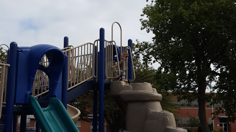
Photo
Where is located West Milwaukee Park
West Milwaukee Park — local attraction, which is located at 5000 W Burnham St, West Milwaukee, WI 53219, United States and belongs to the category — park. Average visitor rating for this place — 4.3 (according to 311 ratings, information from open sources and relevant for 2022).
Exact location — West Milwaukee Park, marked on the map with a red marker.
You can get directions to West Milwaukee Park on the map from your location.
What else is interesting in Brookfield? You can see all the sights if you go to the city page.
Coordinates
West Milwaukee Park, United States coordinates in decimal format: latitude — 43.01856618024763, longitude — -88.10582367497331. When converted to degrees, minutes, seconds West Milwaukee Park has the following coordinates: 43°1′6.84 north latitude and -88°6′20.97 east longitude.
Nearby cities
The largest cities that are located nearby:
- Milwaukee — 16 km
- Madison — 105 km
- Rockford — 119 km
- Chicago — 136 km
- Aurora — 145 km
- Naperville — 145 km
- Green Bay — 161 km
- Joliet — 170 km
- Grand Rapids — 198 km
- South Bend — 217 km
- Peoria — 290 km
- Lansing — 291 km
- Fort Wayne — 330 km
- Flint — 357 km
- Ann Arbor — 367 km
- Indianapolis — 400 km
- Toledo — 406 km
- Sterling Heights — 417 km
- Warren — 419 km
Distance to the capital
Distance to the capital (Washington) is about — 1035 km.