 Warner Robins
Wantagh
Bethel
Misty Hill Farm
United States
Wakonda Beach (R33) Airport
Wilmington
Poland
Miami International Airport
Warner Robins
Wantagh
Bethel
Misty Hill Farm
United States
Wakonda Beach (R33) Airport
Wilmington
Poland
Miami International Airport
Lick Creek Park on the map, College Station, United States
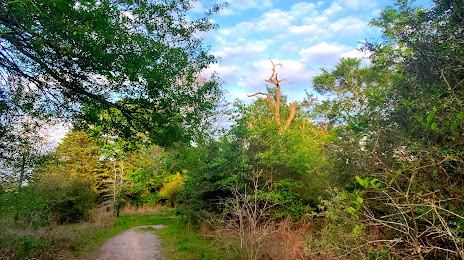
Photo
Where is located Lick Creek Park
Lick Creek Park — local attraction, which is located at 13600 Rock Prairie Rd, College Station, TX 77845, United States and belongs to the category — city park. Average visitor rating for this place — 4.6 (according to 449 ratings, information from open sources and relevant for 2022).
Exact location — Lick Creek Park, marked on the map with a red marker.
You can get directions to Lick Creek Park on the map from your location.
What else is interesting in College Station? You can see all the sights if you go to the city page.
Coordinates
Lick Creek Park, United States coordinates in decimal format: latitude — 30.567175411211554, longitude — -96.21109597532308. When converted to degrees, minutes, seconds Lick Creek Park has the following coordinates: 30°34′1.83 north latitude and -96°12′39.95 east longitude.
Nearby cities
The largest cities that are located nearby:
- Waco — 127 km
- Houston — 133 km
- Austin — 140 km
- Killeen — 143 km
- Beaumont — 220 km
- Mesquite — 238 km
- Dallas — 241 km
- Grand Prairie — 242 km
- Arlington — 244 km
- San Antonio — 247 km
- Irving — 248 km
- Fort Worth — 253 km
- Garland — 254 km
- Richardson — 259 km
- Carrollton — 265 km
- Plano — 267 km
- Frisco — 283 km
- Denton — 295 km
- Shreveport — 319 km
Distance to the capital
Distance to the capital (Washington) is about — 1977 km.