 Warner Robins
Wantagh
Bethel
Misty Hill Farm
United States
Wakonda Beach (R33) Airport
Wilmington
Poland
Miami International Airport
Warner Robins
Wantagh
Bethel
Misty Hill Farm
United States
Wakonda Beach (R33) Airport
Wilmington
Poland
Miami International Airport
San Jacinto Battleground State Historic Site on the map, Channelview, United States
Photo
Where is located San Jacinto Battleground State Historic Site
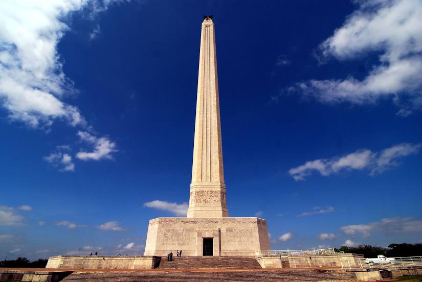
San Jacinto Battleground State Historic Site — local attraction, which is located at 3523 Independence Pkwy, La Porte, TX 77571, United States and belongs to the category — museum. Average visitor rating for this place — 4.7 (according to 4556 ratings, information from open sources and relevant for 2022).
Exact location — San Jacinto Battleground State Historic Site, marked on the map with a red marker.
You can get directions to San Jacinto Battleground State Historic Site on the map from your location.
What else is interesting in Channelview? You can see all the sights if you go to the city page.
Coordinates
San Jacinto Battleground State Historic Site, United States coordinates in decimal format: latitude — 29.747351564461272, longitude — -95.0797158753424. When converted to degrees, minutes, seconds San Jacinto Battleground State Historic Site has the following coordinates: 29°44′50.47 north latitude and -95°4′46.98 east longitude.
Nearby cities
The largest cities that are located nearby:
- Houston — 25 km
- Beaumont — 100 km
- Austin — 257 km
- Waco — 274 km
- Killeen — 288 km
- Lafayette — 300 km
- Corpus Christi — 312 km
- San Antonio — 328 km
- Shreveport — 329 km
- Mesquite — 358 km
- Dallas — 367 km
- Grand Prairie — 372 km
- Garland — 375 km
- Arlington — 376 km
- Irving — 377 km
- Richardson — 381 km
- Baton Rouge — 386 km
- Plano — 388 km
- Fort Worth — 389 km
Distance to the capital
Distance to the capital (Washington) is about — 1940 km.