 Warner Robins
Wantagh
Bethel
Misty Hill Farm
United States
Wakonda Beach (R33) Airport
Wilmington
Poland
Miami International Airport
Warner Robins
Wantagh
Bethel
Misty Hill Farm
United States
Wakonda Beach (R33) Airport
Wilmington
Poland
Miami International Airport
Kelley agricultural historical museum on the map, Kokomo, United States
Photo
Where is located Kelley agricultural historical museum
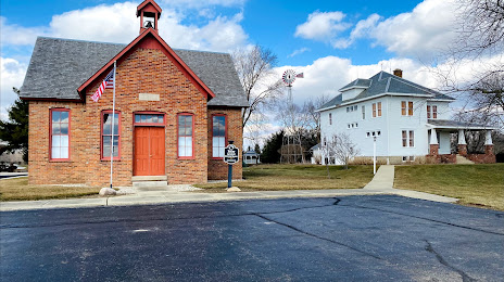
Kelley agricultural historical museum — local attraction, which is located at 6032 W 550 N, Sharpsville, IN 46068, United States and belongs to the category — museum. Average visitor rating for this place — 4.6 (according to 16 ratings, information from open sources and relevant for 2022).
Exact location — Kelley agricultural historical museum, marked on the map with a red marker.
You can get directions to Kelley agricultural historical museum on the map from your location.
What else is interesting in Kokomo? You can see all the sights if you go to the city page.
Coordinates
Kelley agricultural historical museum, United States coordinates in decimal format: latitude — 40.38272570305901, longitude — -86.1290367750557. When converted to degrees, minutes, seconds Kelley agricultural historical museum has the following coordinates: 40°22′57.81 north latitude and -86°7′44.53 east longitude.
Nearby cities
The largest cities that are located nearby:
- Indianapolis — 79 km
- Fort Wayne — 106 km
- South Bend — 132 km
- Chicago — 197 km
- Joliet — 198 km
- Springfield — 207 km
- Cincinnati — 207 km
- Naperville — 217 km
- Aurora — 229 km
- Louisville — 249 km
- Toledo — 250 km
- Columbus — 272 km
- Grand Rapids — 276 km
- Ann Arbor — 279 km
- Lansing — 279 km
- Peoria — 291 km
- Evansville — 305 km
- Rockford — 312 km
- Milwaukee — 316 km
Distance to the capital
Distance to the capital (Washington) is about — 795 km.