 Warner Robins
Wantagh
Bethel
Misty Hill Farm
United States
Wakonda Beach (R33) Airport
Wilmington
Poland
Miami International Airport
Warner Robins
Wantagh
Bethel
Misty Hill Farm
United States
Wakonda Beach (R33) Airport
Wilmington
Poland
Miami International Airport
Timpanogos Cave National Monument on the map, American Fork, United States
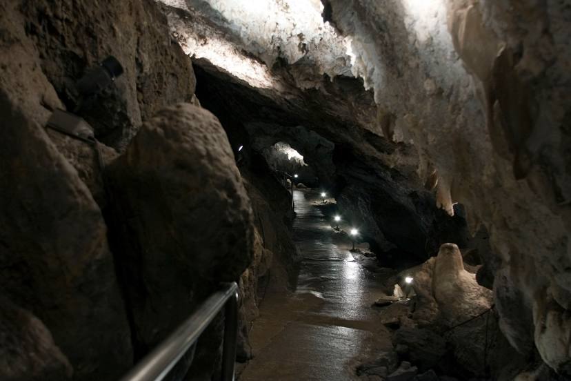
Photo
Where is located Timpanogos Cave National Monument
Timpanogos Cave National Monument — local attraction, which is located at 2038 Alpine Loop Rd, American Fork, UT 84003, United States and belongs to the category — national monument. Average visitor rating for this place — 4.8 (according to 912 ratings, information from open sources and relevant for 2022).
Exact location — Timpanogos Cave National Monument, marked on the map with a red marker.
You can get directions to Timpanogos Cave National Monument on the map from your location.
What else is interesting in American Fork? You can see all the sights if you go to the city page.
Coordinates
Timpanogos Cave National Monument, United States coordinates in decimal format: latitude — 40.4405188346226, longitude — -111.70950877505393. When converted to degrees, minutes, seconds Timpanogos Cave National Monument has the following coordinates: 40°26′25.87 north latitude and -111°42′34.23 east longitude.
Nearby cities
The largest cities that are located nearby:
- Provo — 20 km
- West Jordan — 28 km
- West Valley City — 39 km
- Salt Lake City — 43 km
- Boise — 504 km
- North Las Vegas — 549 km
- Las Vegas — 553 km
- Henderson — 558 km
- Spring Valley — 564 km
- Fort Collins — 564 km
- Arvada — 573 km
- Lakewood — 576 km
- Westminster — 577 km
- Thornton — 582 km
- Denver — 583 km
- Aurora — 596 km
- Colorado Springs — 624 km
- Pueblo — 667 km
- Reno — 690 km
Distance to the capital
Distance to the capital (Washington) is about — 2954 km.