 Warner Robins
Wantagh
Bethel
Misty Hill Farm
United States
Wakonda Beach (R33) Airport
Wilmington
Poland
Miami International Airport
Warner Robins
Wantagh
Bethel
Misty Hill Farm
United States
Wakonda Beach (R33) Airport
Wilmington
Poland
Miami International Airport
Sourdough/Bozeman Creek Trailhead on the map, Bozeman, United States
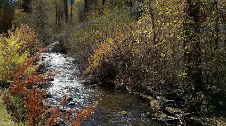
Photo
Where is located Sourdough/Bozeman Creek Trailhead
Sourdough/Bozeman Creek Trailhead — local attraction, which is located at Bozeman, MT 59771, United States and belongs to the category — hiking area. Average visitor rating for this place — 4.7 (according to 123 ratings, information from open sources and relevant for 2022).
Exact location — Sourdough/Bozeman Creek Trailhead, marked on the map with a red marker.
You can get directions to Sourdough/Bozeman Creek Trailhead on the map from your location.
What else is interesting in Bozeman? You can see all the sights if you go to the city page.
Coordinates
Sourdough/Bozeman Creek Trailhead, United States coordinates in decimal format: latitude — 45.59258019506694, longitude — -111.02642847488877. When converted to degrees, minutes, seconds Sourdough/Bozeman Creek Trailhead has the following coordinates: 45°35′33.29 north latitude and -111°1′35.14 east longitude.
Nearby cities
The largest cities that are located nearby:
- Boise — 472 km
- Spokane — 523 km
- Salt Lake City — 548 km
- West Valley City — 557 km
- West Jordan — 565 km
- Provo — 604 km
- Calgary
 (Canada) — 630 km
 - Regina (Canada) — 696 km
- Fort Collins — 753 km
- Kelowna (Canada) — 761 km
- Saskatoon (Canada) — 773 km
- Westminster — 823 km
- Arvada — 823 km
- Thornton — 823 km
- Lakewood — 833 km
- Denver — 834 km
- Aurora — 843 km
- Bellevue — 859 km
- Seattle — 868 km
Distance to the capital
Distance to the capital (Washington) is about — 2872 km.