 Warner Robins
Wantagh
Bethel
Misty Hill Farm
United States
Wakonda Beach (R33) Airport
Wilmington
Poland
Miami International Airport
Warner Robins
Wantagh
Bethel
Misty Hill Farm
United States
Wakonda Beach (R33) Airport
Wilmington
Poland
Miami International Airport
Ziegler Park on the map, Cincinnati, United States
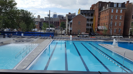
Photo
Where is located Ziegler Park
Ziegler Park — local attraction, which is located at 1322 Sycamore St, Cincinnati, OH 45202, United States and belongs to the category — park. Average visitor rating for this place — 4.5 (according to 400 ratings, information from open sources and relevant for 2022).
Exact location — Ziegler Park, marked on the map with a red marker.
You can get directions to Ziegler Park on the map from your location.
What else is interesting in Cincinnati? You can see all the sights if you go to the city page.
Coordinates
Ziegler Park, United States coordinates in decimal format: latitude — 39.12695500732161, longitude — -84.45574036979033. When converted to degrees, minutes, seconds Ziegler Park has the following coordinates: 39°7′37.04 north latitude and -84°27′20.67 east longitude.
Nearby cities
The largest cities that are located nearby:
- Springfield — 109 km
- Louisville — 143 km
- Indianapolis — 158 km
- Columbus — 160 km
- Fort Wayne — 225 km
- Toledo — 294 km
- Evansville — 295 km
- South Bend — 319 km
- Akron — 332 km
- Knoxville — 351 km
- Cleveland — 353 km
- Ann Arbor — 357 km
- Aurora — 359 km
- Windsor
 (Canada) — 375 km
 - Detroit — 377 km
- Clarksville — 381 km
- Nashville — 383 km
- Warren — 396 km
- Joliet — 399 km
Distance to the capital
Distance to the capital (Washington) is about — 641 km.