 Warner Robins
Wantagh
Bethel
Misty Hill Farm
United States
Wakonda Beach (R33) Airport
Wilmington
Poland
Miami International Airport
Warner Robins
Wantagh
Bethel
Misty Hill Farm
United States
Wakonda Beach (R33) Airport
Wilmington
Poland
Miami International Airport
East Harbor State Park on the map, Sandusky, United States
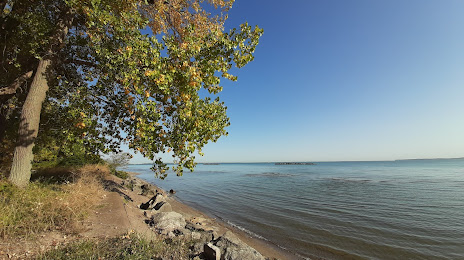
Photo
Where is located East Harbor State Park
East Harbor State Park — local attraction, which is located at 1169 N Buck Rd, Lakeside Marblehead, OH 43440, United States and belongs to the category — state park. Average visitor rating for this place — 4.6 (according to 3202 ratings, information from open sources and relevant for 2022).
Exact location — East Harbor State Park, marked on the map with a red marker.
You can get directions to East Harbor State Park on the map from your location.
What else is interesting in Sandusky? You can see all the sights if you go to the city page.
Coordinates
East Harbor State Park, United States coordinates in decimal format: latitude — 41.545014945001945, longitude — -82.81768247501986. When converted to degrees, minutes, seconds East Harbor State Park has the following coordinates: 41°32′42.05 north latitude and -82°49′3.66 east longitude.
Nearby cities
The largest cities that are located nearby:
- Toledo — 74 km
- Cleveland — 84 km
- Windsor
 (Canada) — 99 km
 - Detroit — 101 km
- Akron — 107 km
- Aurora — 114 km
- Warren — 120 km
- Ann Arbor — 125 km
- Sterling Heights — 128 km
- Columbus — 166 km
- Flint — 190 km
- Springfield — 193 km
- Lansing — 207 km
- Fort Wayne — 207 km
- London (Canada) — 207 km
- Pittsburgh — 254 km
- Kitchener (Canada) — 282 km
- Waterloo (Canada) — 284 km
- Cambridge (Canada) — 286 km
Distance to the capital
Distance to the capital (Washington) is about — 572 km.