 Warner Robins
Wantagh
Bethel
Misty Hill Farm
United States
Wakonda Beach (R33) Airport
Wilmington
Poland
Miami International Airport
Warner Robins
Wantagh
Bethel
Misty Hill Farm
United States
Wakonda Beach (R33) Airport
Wilmington
Poland
Miami International Airport
Mormon Island State Recreation Area on the map, Grand Island, United States
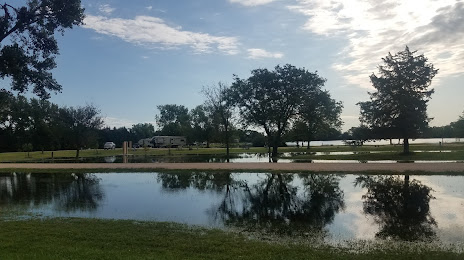
Photo
Where is located Mormon Island State Recreation Area
Mormon Island State Recreation Area — local attraction, which is located at 7425 US-281, Doniphan, NE 68832, United States and belongs to the category — state park. Average visitor rating for this place — 4.4 (according to 944 ratings, information from open sources and relevant for 2022).
Exact location — Mormon Island State Recreation Area, marked on the map with a red marker.
You can get directions to Mormon Island State Recreation Area on the map from your location.
What else is interesting in Grand Island? You can see all the sights if you go to the city page.
Coordinates
Mormon Island State Recreation Area, United States coordinates in decimal format: latitude — 40.82351184473814, longitude — -98.37639687504222. When converted to degrees, minutes, seconds Mormon Island State Recreation Area has the following coordinates: 40°49′24.64 north latitude and -98°22′35.03 east longitude.
Nearby cities
The largest cities that are located nearby:
- Lincoln — 139 km
- Omaha — 198 km
- Topeka — 308 km
- Sioux Falls — 317 km
- Wichita — 369 km
- Olathe — 378 km
- North Kansas City — 379 km
- Kansas City — 381 km
- Overland Park — 382 km
- Independence — 393 km
- Des Moines — 398 km
- Fort Collins — 567 km
- Aurora — 567 km
- Tulsa — 568 km
- Thornton — 575 km
- Denver — 580 km
- Westminster — 581 km
- Arvada — 586 km
- Lakewood — 589 km
Distance to the capital
Distance to the capital (Washington) is about — 1830 km.