 Warner Robins
Wantagh
Bethel
Misty Hill Farm
United States
Wakonda Beach (R33) Airport
Wilmington
Poland
Miami International Airport
Warner Robins
Wantagh
Bethel
Misty Hill Farm
United States
Wakonda Beach (R33) Airport
Wilmington
Poland
Miami International Airport
Pewaukee Kiwanis Village Park on the map, Menomonee Falls, United States
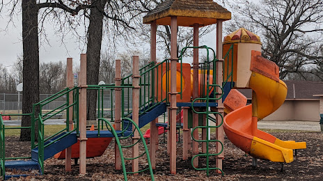
Photo
Where is located Pewaukee Kiwanis Village Park
Pewaukee Kiwanis Village Park — local attraction, which is located at 325 Capitol Dr, Pewaukee, WI 53072, United States and belongs to the category — park. Average visitor rating for this place — 4.5 (according to 208 ratings, information from open sources and relevant for 2022).
Exact location — Pewaukee Kiwanis Village Park, marked on the map with a red marker.
You can get directions to Pewaukee Kiwanis Village Park on the map from your location.
What else is interesting in Menomonee Falls? You can see all the sights if you go to the city page.
Coordinates
Pewaukee Kiwanis Village Park, United States coordinates in decimal format: latitude — 43.12652962442755, longitude — -88.19818503971139. When converted to degrees, minutes, seconds Pewaukee Kiwanis Village Park has the following coordinates: 43°7′35.51 north latitude and -88°11′53.47 east longitude.
Nearby cities
The largest cities that are located nearby:
- Milwaukee — 23 km
- Madison — 104 km
- Rockford — 128 km
- Green Bay — 148 km
- Chicago — 149 km
- Aurora — 158 km
- Naperville — 158 km
- Joliet — 183 km
- Grand Rapids — 200 km
- South Bend — 227 km
- Lansing — 293 km
- Peoria — 301 km
- Fort Wayne — 340 km
- Flint — 359 km
- Ann Arbor — 371 km
- Indianapolis — 412 km
- Toledo — 412 km
- Sterling Heights — 419 km
- Warren — 422 km
Distance to the capital
Distance to the capital (Washington) is about — 1046 km.