 Warner Robins
Wantagh
Bethel
Misty Hill Farm
United States
Wakonda Beach (R33) Airport
Wilmington
Poland
Miami International Airport
Warner Robins
Wantagh
Bethel
Misty Hill Farm
United States
Wakonda Beach (R33) Airport
Wilmington
Poland
Miami International Airport
Lake Wichita Park on the map, Wichita Falls, United States
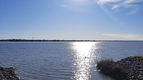
Photo
Where is located Lake Wichita Park
Lake Wichita Park — local attraction, which is located at 5205 Fairway Blvd, Wichita Falls, TX 76310, United States and belongs to the category — city park. Average visitor rating for this place — 4.5 (according to 576 ratings, information from open sources and relevant for 2022).
Exact location — Lake Wichita Park, marked on the map with a red marker.
You can get directions to Lake Wichita Park on the map from your location.
What else is interesting in Wichita Falls? You can see all the sights if you go to the city page.
Coordinates
Lake Wichita Park, United States coordinates in decimal format: latitude — 33.84739618317078, longitude — -98.5584319752409. When converted to degrees, minutes, seconds Lake Wichita Park has the following coordinates: 33°50′50.63 north latitude and -98°33′30.36 east longitude.
Nearby cities
The largest cities that are located nearby:
- Denton — 148 km
- Fort Worth — 168 km
- Norman — 173 km
- Frisco — 176 km
- Carrollton — 181 km
- Arlington — 183 km
- Irving — 188 km
- Grand Prairie — 190 km
- Oklahoma City — 193 km
- Plano — 194 km
- Richardson — 195 km
- Abilene — 199 km
- Dallas — 202 km
- Garland — 205 km
- Mesquite — 217 km
- Waco — 291 km
- Lubbock — 312 km
- Killeen — 318 km
- Tulsa — 333 km
Distance to the capital
Distance to the capital (Washington) is about — 2002 km.