 Warner Robins
Wantagh
Bethel
Misty Hill Farm
United States
Wakonda Beach (R33) Airport
Wilmington
Poland
Miami International Airport
Warner Robins
Wantagh
Bethel
Misty Hill Farm
United States
Wakonda Beach (R33) Airport
Wilmington
Poland
Miami International Airport
Arnette Park on the map, Hope Mills, United States
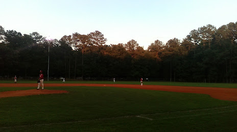
Photo
Where is located Arnette Park
Arnette Park — local attraction, which is located at 2165 Wilmington Hwy, Fayetteville, NC 28306, United States and belongs to the category — park. Average visitor rating for this place — 4.5 (according to 634 ratings, information from open sources and relevant for 2022).
Exact location — Arnette Park, marked on the map with a red marker.
You can get directions to Arnette Park on the map from your location.
What else is interesting in Hope Mills? You can see all the sights if you go to the city page.
Coordinates
Arnette Park, United States coordinates in decimal format: latitude — 34.9890901287271, longitude — -78.90835534329587. When converted to degrees, minutes, seconds Arnette Park has the following coordinates: 34°59′20.72 north latitude and -78°54′30.08 east longitude.
Nearby cities
The largest cities that are located nearby:
- Fayetteville — 11 km
- Cary — 92 km
- Raleigh — 94 km
- Durham — 113 km
- Greensboro — 143 km
- Winston-Salem — 170 km
- Charlotte — 174 km
- Columbia — 219 km
- Charleston — 259 km
- Chesapeake — 308 km
- Richmond — 313 km
- Norfolk — 314 km
- Hampton — 323 km
- Virginia Beach — 335 km
- Savannah — 378 km
- Alexandria — 454 km
- Knoxville — 459 km
- Baltimore — 518 km
- Atlanta — 518 km
Distance to the capital
Distance to the capital (Washington) is about — 466 km.