 Warner Robins
Wantagh
Bethel
Misty Hill Farm
United States
Wakonda Beach (R33) Airport
Wilmington
Poland
Miami International Airport
Warner Robins
Wantagh
Bethel
Misty Hill Farm
United States
Wakonda Beach (R33) Airport
Wilmington
Poland
Miami International Airport
USS Lexington on the map, Corpus Christi, United States
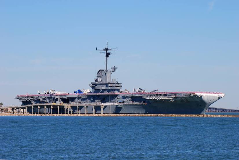
Photo
Where is located USS Lexington
USS Lexington — local attraction, which is located at 2914 N Shoreline Blvd, Corpus Christi, TX 78402, United States and belongs to the category — essex-class aircraft carrier. Average visitor rating for this place — 4.8 (according to 9942 ratings, information from open sources and relevant for 2022).
Exact location — USS Lexington, marked on the map with a red marker.
You can get directions to USS Lexington on the map from your location.
What else is interesting in Corpus Christi? You can see all the sights if you go to the city page.
Coordinates
USS Lexington, United States coordinates in decimal format: latitude — 27.81503018130573, longitude — -97.38876697538613. When converted to degrees, minutes, seconds USS Lexington has the following coordinates: 27°48′54.11 north latitude and -97°23′19.56 east longitude.
Nearby cities
The largest cities that are located nearby:
- McAllen — 195 km
- Laredo — 206 km
- Reynosa
 (Mexico) — 208 km
 - San Antonio — 208 km
- Brownsville — 210 km
- Matamoros (Mexico) — 214 km
- Nuevo Laredo (Mexico) — 214 km
- Austin — 275 km
- Houston — 291 km
- Piedras Negras (Mexico) — 319 km
- Apodaca (Mexico) — 356 km
- San Nicolas de los Garza (Mexico) — 366 km
- General Escobedo (Mexico) — 367 km
- Killeen — 368 km
- Guadalupe (Mexico) — 369 km
- Monterrey (Mexico) — 373 km
- Ciudad Acuna (Mexico) — 382 km
- San Pedro Garza García (Mexico) — 382 km
- Santa Catarina (Mexico) — 386 km
Distance to the capital
Distance to the capital (Washington) is about — 2249 km.