 Warner Robins
Wantagh
Bethel
Misty Hill Farm
United States
Wakonda Beach (R33) Airport
Wilmington
Poland
Miami International Airport
Warner Robins
Wantagh
Bethel
Misty Hill Farm
United States
Wakonda Beach (R33) Airport
Wilmington
Poland
Miami International Airport
Steamtown National Historic Site on the map, Scranton, United States
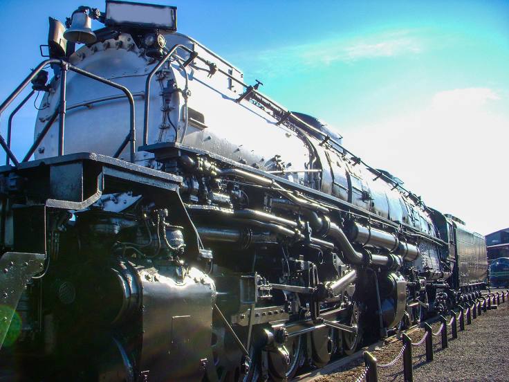
Photo
Where is located Steamtown National Historic Site
Steamtown National Historic Site — local attraction, which is located at 350 Cliff St, Scranton, PA 18503, United States and belongs to the category — museum. Average visitor rating for this place — 4.7 (according to 2050 ratings, information from open sources and relevant for 2022).
Exact location — Steamtown National Historic Site, marked on the map with a red marker.
You can get directions to Steamtown National Historic Site on the map from your location.
What else is interesting in Scranton? You can see all the sights if you go to the city page.
Coordinates
Steamtown National Historic Site, United States coordinates in decimal format: latitude — 41.40786956847467, longitude — -75.67207577502414. When converted to degrees, minutes, seconds Steamtown National Historic Site has the following coordinates: 41°24′28.33 north latitude and -75°40′19.47 east longitude.
Nearby cities
The largest cities that are located nearby:
- Allentown — 90 km
- Paterson — 136 km
- Edison — 144 km
- Newark — 145 km
- Elizabeth — 147 km
- Yonkers — 157 km
- New York — 159 km
- Brooklyn — 161 km
- Philadelphia — 166 km
- Stamford — 181 km
- Syracuse — 185 km
- Toms River — 203 km
- Bridgeport — 207 km
- Waterbury — 217 km
- New Haven — 227 km
- Baltimore — 248 km
- Hartford — 249 km
- Rochester — 249 km
- Springfield — 263 km
Distance to the capital
Distance to the capital (Washington) is about — 301 km.