 Warner Robins
Wantagh
Bethel
Misty Hill Farm
United States
Wakonda Beach (R33) Airport
Wilmington
Poland
Miami International Airport
Warner Robins
Wantagh
Bethel
Misty Hill Farm
United States
Wakonda Beach (R33) Airport
Wilmington
Poland
Miami International Airport
Octagon Center For the Arts on the map, Ames, United States
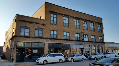
Photo
Where is located Octagon Center For the Arts
Octagon Center For the Arts — local attraction, which is located at 427 Douglas Ave, Ames, IA 50010, United States and belongs to the category — arts organization. Average visitor rating for this place — 4.7 (according to 74 ratings, information from open sources and relevant for 2022).
Exact location — Octagon Center For the Arts, marked on the map with a red marker.
You can get directions to Octagon Center For the Arts on the map from your location.
What else is interesting in Ames? You can see all the sights if you go to the city page.
Coordinates
Octagon Center For the Arts, United States coordinates in decimal format: latitude — 42.02572251487307, longitude — -93.61238157500482. When converted to degrees, minutes, seconds Octagon Center For the Arts has the following coordinates: 42°1′32.6 north latitude and -93°36′44.57 east longitude.
Nearby cities
The largest cities that are located nearby:
- Des Moines — 48 km
- Omaha — 216 km
- Lincoln — 289 km
- Sioux Falls — 300 km
- Saint Paul — 325 km
- Minneapolis — 327 km
- North Kansas City — 330 km
- Independence — 333 km
- Kansas City — 335 km
- Overland Park — 349 km
- Madison — 360 km
- Olathe — 364 km
- Peoria — 369 km
- Rockford — 371 km
- Topeka — 374 km
- Aurora — 438 km
- Naperville — 452 km
- Joliet — 462 km
- Milwaukee — 475 km
Distance to the capital
Distance to the capital (Washington) is about — 1442 km.