 Warner Robins
Wantagh
Bethel
Misty Hill Farm
United States
Wakonda Beach (R33) Airport
Wilmington
Poland
Miami International Airport
Warner Robins
Wantagh
Bethel
Misty Hill Farm
United States
Wakonda Beach (R33) Airport
Wilmington
Poland
Miami International Airport
Arcadia Round Barn on the map, Edmond, United States
Photo
Where is located Arcadia Round Barn
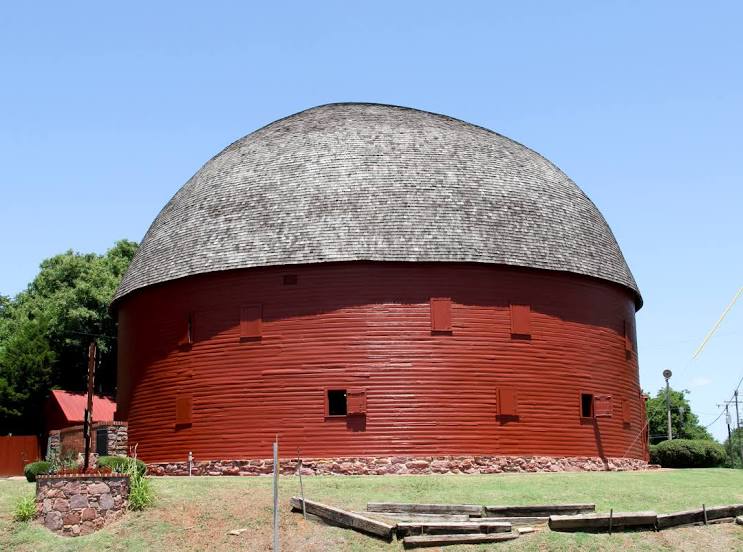
Arcadia Round Barn — local attraction, which is located at 107 OK-66, Arcadia, OK 73007, United States and belongs to the category — historical landmark. Average visitor rating for this place — 4.6 (according to 1047 ratings, information from open sources and relevant for 2022).
Exact location — Arcadia Round Barn, marked on the map with a red marker.
You can get directions to Arcadia Round Barn on the map from your location.
What else is interesting in Edmond? You can see all the sights if you go to the city page.
Coordinates
Arcadia Round Barn, United States coordinates in decimal format: latitude — 35.66233295449648, longitude — -97.3260337751923. When converted to degrees, minutes, seconds Arcadia Round Barn has the following coordinates: 35°39′44.4 north latitude and -97°19′33.72 east longitude.
Nearby cities
The largest cities that are located nearby:
- Oklahoma City — 21 km
- Norman — 48 km
- Tulsa — 144 km
- Wichita Falls — 214 km
- Wichita — 225 km
- Denton — 271 km
- Frisco — 283 km
- Plano — 300 km
- Carrollton — 301 km
- Richardson — 307 km
- Garland — 313 km
- Irving — 318 km
- Fort Worth — 321 km
- Dallas — 324 km
- Arlington — 324 km
- Grand Prairie — 324 km
- Mesquite — 329 km
- Amarillo — 396 km
- Topeka — 406 km
Distance to the capital
Distance to the capital (Washington) is about — 1827 km.