 Warner Robins
Wantagh
Bethel
Misty Hill Farm
United States
Wakonda Beach (R33) Airport
Wilmington
Poland
Miami International Airport
Warner Robins
Wantagh
Bethel
Misty Hill Farm
United States
Wakonda Beach (R33) Airport
Wilmington
Poland
Miami International Airport
Leila Arboretum Society on the map, Battle Creek, United States
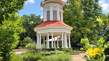
Photo
Where is located Leila Arboretum Society
Leila Arboretum Society — local attraction, which is located at 928 W Michigan Ave, Battle Creek, MI 49037, United States and belongs to the category — non-profit organization. Average visitor rating for this place — 4.7 (according to 900 ratings, information from open sources and relevant for 2022).
Exact location — Leila Arboretum Society, marked on the map with a red marker.
You can get directions to Leila Arboretum Society on the map from your location.
What else is interesting in Battle Creek? You can see all the sights if you go to the city page.
Coordinates
Leila Arboretum Society, United States coordinates in decimal format: latitude — 42.33512308991132, longitude — -85.21343657499506. When converted to degrees, minutes, seconds Leila Arboretum Society has the following coordinates: 42°20′6.44 north latitude and -85°12′48.37 east longitude.
Nearby cities
The largest cities that are located nearby:
- Lansing — 68 km
- Grand Rapids — 81 km
- South Bend — 114 km
- Ann Arbor — 118 km
- Fort Wayne — 137 km
- Flint — 143 km
- Toledo — 153 km
- Detroit — 174 km
- Windsor
 (Canada) — 175 km
 - Sterling Heights — 177 km
- Warren — 178 km
- Chicago — 208 km
- Milwaukee — 234 km
- Naperville — 253 km
- Joliet — 256 km
- Aurora — 266 km
- Springfield — 289 km
- Indianapolis — 294 km
- Cleveland — 303 km
Distance to the capital
Distance to the capital (Washington) is about — 788 km.