 Warner Robins
Wantagh
Bethel
Misty Hill Farm
United States
Wakonda Beach (R33) Airport
Wilmington
Poland
Miami International Airport
Warner Robins
Wantagh
Bethel
Misty Hill Farm
United States
Wakonda Beach (R33) Airport
Wilmington
Poland
Miami International Airport
Upper Pithlachascotee River Preserve on the map, Land O' Lakes, United States
Photo
Where is located Upper Pithlachascotee River Preserve
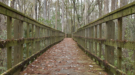
Upper Pithlachascotee River Preserve — local attraction, which is located at 17135 Minneola Dr, Spring Hill, FL 34610, United States and belongs to the category — hiking area. Average visitor rating for this place — 4.3 (according to 173 ratings, information from open sources and relevant for 2022).
Exact location — Upper Pithlachascotee River Preserve, marked on the map with a red marker.
You can get directions to Upper Pithlachascotee River Preserve on the map from your location.
What else is interesting in Land O' Lakes? You can see all the sights if you go to the city page.
Coordinates
Upper Pithlachascotee River Preserve, United States coordinates in decimal format: latitude — 28.24698353739853, longitude — -82.47721711864152. When converted to degrees, minutes, seconds Upper Pithlachascotee River Preserve has the following coordinates: 28°14′49.14 north latitude and -82°28′37.98 east longitude.
Nearby cities
The largest cities that are located nearby:
- Tampa — 30 km
- Brandon — 35 km
- Clearwater — 44 km
- Saint Petersburg — 52 km
- Orlando — 111 km
- Gainesville — 159 km
- Cape Coral — 190 km
- Port Saint Lucie — 231 km
- Jacksonville — 246 km
- Tallahassee — 301 km
- Coral Springs — 306 km
- Pembroke Pines — 325 km
- Miramar — 327 km
- Fort Lauderdale — 327 km
- Hollywood — 335 km
- Hialeah — 339 km
- Miami — 353 km
- Savannah — 446 km
- Charleston — 556 km
Distance to the capital
Distance to the capital (Washington) is about — 1288 km.