 Warner Robins
Wantagh
Bethel
Misty Hill Farm
United States
Wakonda Beach (R33) Airport
Wilmington
Poland
Miami International Airport
Warner Robins
Wantagh
Bethel
Misty Hill Farm
United States
Wakonda Beach (R33) Airport
Wilmington
Poland
Miami International Airport
Hammel Woods - Crumby Recreation Area on the map, Romeoville, United States
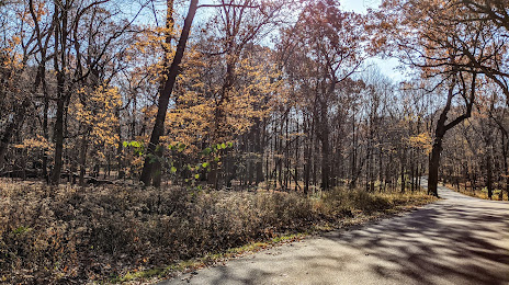
Photo
Where is located Hammel Woods - Crumby Recreation Area
Hammel Woods - Crumby Recreation Area — local attraction, which is located at 23601 W Black Rd, Shorewood, IL 60431, United States and belongs to the category — hiking area. Average visitor rating for this place — 4.7 (according to 84 ratings, information from open sources and relevant for 2022).
Exact location — Hammel Woods - Crumby Recreation Area, marked on the map with a red marker.
You can get directions to Hammel Woods - Crumby Recreation Area on the map from your location.
What else is interesting in Romeoville? You can see all the sights if you go to the city page.
Coordinates
Hammel Woods - Crumby Recreation Area, United States coordinates in decimal format: latitude — 41.53602483997906, longitude — -88.19094537502014. When converted to degrees, minutes, seconds Hammel Woods - Crumby Recreation Area has the following coordinates: 41°32′9.69 north latitude and -88°11′27.4 east longitude.
Nearby cities
The largest cities that are located nearby:
- Naperville — 13 km
- Joliet — 14 km
- Aurora — 23 km
- Chicago — 46 km
- Rockford — 107 km
- South Bend — 152 km
- Milwaukee — 155 km
- Peoria — 164 km
- Madison — 190 km
- Grand Rapids — 244 km
- Fort Wayne — 254 km
- Indianapolis — 265 km
- Lansing — 311 km
- Green Bay — 318 km
- Ann Arbor — 362 km
- Toledo — 375 km
- Saint Louis — 380 km
- Flint — 387 km
- Evansville — 409 km
Distance to the capital
Distance to the capital (Washington) is about — 991 km.