 Warner Robins
Wantagh
Bethel
Misty Hill Farm
United States
Wakonda Beach (R33) Airport
Wilmington
Poland
Miami International Airport
Warner Robins
Wantagh
Bethel
Misty Hill Farm
United States
Wakonda Beach (R33) Airport
Wilmington
Poland
Miami International Airport
Cartersville Bridge on the map, Cartersville, United States
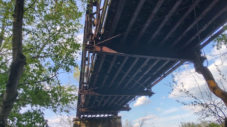
Photo
Where is located Cartersville Bridge
Cartersville Bridge — local attraction, which is located at Cartersville Rd, Goochland, VA 23063, United States and belongs to the category — bridge. Average visitor rating for this place — 5.0 (according to 1 rating, information from open sources and relevant for 2022).
Exact location — Cartersville Bridge, marked on the map with a red marker.
You can get directions to Cartersville Bridge on the map from your location.
What else is interesting in Cartersville? You can see all the sights if you go to the city page.
Coordinates
Cartersville Bridge, United States coordinates in decimal format: latitude — 34.13207811719892, longitude — -84.84884387523343. When converted to degrees, minutes, seconds Cartersville Bridge has the following coordinates: 34°7′55.48 north latitude and -84°50′55.84 east longitude.
Nearby cities
The largest cities that are located nearby:
- Atlanta — 60 km
- Chattanooga — 108 km
- Huntsville — 174 km
- Birmingham — 198 km
- Knoxville — 214 km
- Montgomery — 243 km
- Nashville — 283 km
- Columbia — 346 km
- Clarksville — 346 km
- Charlotte — 376 km
- Tallahassee — 415 km
- Savannah — 416 km
- Louisville — 460 km
- Winston-Salem — 460 km
- Charleston — 478 km
- Evansville — 485 km
- Memphis — 487 km
- Mobile — 492 km
- Greensboro — 495 km
Distance to the capital
Distance to the capital (Washington) is about — 877 km.