 Warner Robins
Wantagh
Bethel
Misty Hill Farm
United States
Wakonda Beach (R33) Airport
Wilmington
Poland
Miami International Airport
Warner Robins
Wantagh
Bethel
Misty Hill Farm
United States
Wakonda Beach (R33) Airport
Wilmington
Poland
Miami International Airport
Kiwanis Park on the map, Benton Harbor, United States
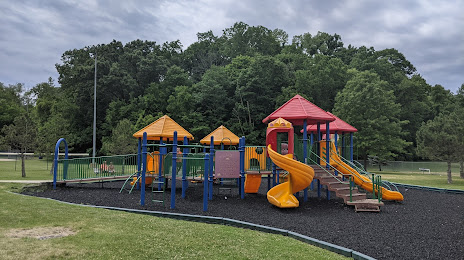
Photo
Where is located Kiwanis Park
Kiwanis Park — local attraction, which is located at 1200 Pearl St, St Joseph, MI 49085, United States and belongs to the category — park. Average visitor rating for this place — 4.3 (according to 269 ratings, information from open sources and relevant for 2022).
Exact location — Kiwanis Park, marked on the map with a red marker.
You can get directions to Kiwanis Park on the map from your location.
What else is interesting in Benton Harbor? You can see all the sights if you go to the city page.
Coordinates
Kiwanis Park, United States coordinates in decimal format: latitude — 42.10122065748823, longitude — -86.47918437500245. When converted to degrees, minutes, seconds Kiwanis Park has the following coordinates: 42°6′4.39 north latitude and -86°28′45.06 east longitude.
Nearby cities
The largest cities that are located nearby:
- South Bend — 51 km
- Chicago — 100 km
- Grand Rapids — 113 km
- Naperville — 146 km
- Joliet — 150 km
- Milwaukee — 155 km
- Fort Wayne — 159 km
- Aurora — 159 km
- Lansing — 169 km
- Rockford — 217 km
- Ann Arbor — 223 km
- Flint — 245 km
- Toledo — 245 km
- Madison — 260 km
- Indianapolis — 261 km
- Detroit — 280 km
- Windsor
 (Canada) — 280 km
 - Sterling Heights — 283 km
- Warren — 284 km
Distance to the capital
Distance to the capital (Washington) is about — 873 km.