 Warner Robins
Wantagh
Bethel
Misty Hill Farm
United States
Wakonda Beach (R33) Airport
Wilmington
Poland
Miami International Airport
Warner Robins
Wantagh
Bethel
Misty Hill Farm
United States
Wakonda Beach (R33) Airport
Wilmington
Poland
Miami International Airport
Trinity River Greenbelt Goat Island Preserve - Dallas County Nature Preserve on the map, Seagoville, United States
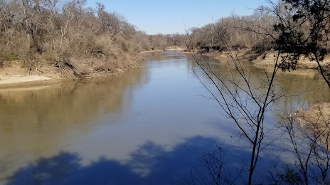
Photo
Where is located Trinity River Greenbelt Goat Island Preserve - Dallas County Nature Preserve
Trinity River Greenbelt Goat Island Preserve - Dallas County Nature Preserve — local attraction, which is located at 2800 Post Oak Rd, Hutchins, TX 75141, United States and belongs to the category — nature preserve. Average visitor rating for this place — 4.2 (according to 72 ratings, information from open sources and relevant for 2022).
Exact location — Trinity River Greenbelt Goat Island Preserve - Dallas County Nature Preserve, marked on the map with a red marker.
You can get directions to Trinity River Greenbelt Goat Island Preserve - Dallas County Nature Preserve on the map from your location.
What else is interesting in Seagoville? You can see all the sights if you go to the city page.
Coordinates
Trinity River Greenbelt Goat Island Preserve - Dallas County Nature Preserve, United States coordinates in decimal format: latitude — 32.633348022770775, longitude — -96.6623813752722. When converted to degrees, minutes, seconds Trinity River Greenbelt Goat Island Preserve - Dallas County Nature Preserve has the following coordinates: 32°38′0.05 north latitude and -96°39′44.57 east longitude.
Nearby cities
The largest cities that are located nearby:
- Mesquite — 15 km
- Dallas — 28 km
- Garland — 32 km
- Richardson — 38 km
- Irving — 43 km
- Grand Prairie — 44 km
- Plano — 45 km
- Carrollton — 49 km
- Arlington — 54 km
- Frisco — 62 km
- Fort Worth — 75 km
- Denton — 84 km
- Waco — 133 km
- Killeen — 203 km
- Wichita Falls — 228 km
- Shreveport — 260 km
- Austin — 286 km
- Norman — 297 km
- Abilene — 299 km
Distance to the capital
Distance to the capital (Washington) is about — 1899 km.