 Warner Robins
Wantagh
Bethel
Misty Hill Farm
United States
Wakonda Beach (R33) Airport
Wilmington
Poland
Miami International Airport
Warner Robins
Wantagh
Bethel
Misty Hill Farm
United States
Wakonda Beach (R33) Airport
Wilmington
Poland
Miami International Airport
Bamforth National Wildlife Refuge on the map, Laramie, United States
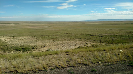
Photo
Where is located Bamforth National Wildlife Refuge
Bamforth National Wildlife Refuge — local attraction, which is located at Laramie, WY 82070, United States and belongs to the category — wildlife refuge. Average visitor rating for this place — 4.6 (according to 187 ratings, information from open sources and relevant for 2022).
Exact location — Bamforth National Wildlife Refuge, marked on the map with a red marker.
You can get directions to Bamforth National Wildlife Refuge on the map from your location.
What else is interesting in Laramie? You can see all the sights if you go to the city page.
Coordinates
Bamforth National Wildlife Refuge, United States coordinates in decimal format: latitude — 41.37194294846178, longitude — -105.73811547502524. When converted to degrees, minutes, seconds Bamforth National Wildlife Refuge has the following coordinates: 41°22′18.99 north latitude and -105°44′17.22 east longitude.
Nearby cities
The largest cities that are located nearby:
- Fort Collins — 91 km
- Thornton — 168 km
- Westminster — 170 km
- Arvada — 172 km
- Denver — 181 km
- Lakewood — 183 km
- Aurora — 186 km
- Colorado Springs — 282 km
- Pueblo — 349 km
- Provo — 526 km
- Salt Lake City — 531 km
- West Jordan — 538 km
- West Valley City — 542 km
- Albuquerque — 694 km
- Valencia — 727 km
- Lincoln — 747 km
- Sioux Falls — 752 km
- Amarillo — 754 km
- Omaha — 797 km
Distance to the capital
Distance to the capital (Washington) is about — 2445 km.