 Warner Robins
Wantagh
Bethel
Misty Hill Farm
United States
Wakonda Beach (R33) Airport
Wilmington
Poland
Miami International Airport
Warner Robins
Wantagh
Bethel
Misty Hill Farm
United States
Wakonda Beach (R33) Airport
Wilmington
Poland
Miami International Airport
Bank Street Beach on the map, Harwich, United States
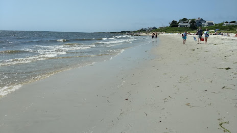
Photo
Where is located Bank Street Beach
Bank Street Beach — local attraction, which is located at 16 Bank St, Harwich Port, MA 02646, United States and belongs to the category — beach. Average visitor rating for this place — 4.6 (according to 181 rating, information from open sources and relevant for 2022).
Exact location — Bank Street Beach, marked on the map with a red marker.
You can get directions to Bank Street Beach on the map from your location.
What else is interesting in Harwich? You can see all the sights if you go to the city page.
Coordinates
Bank Street Beach, United States coordinates in decimal format: latitude — 41.66401370405414, longitude — -70.07209252511069. When converted to degrees, minutes, seconds Bank Street Beach has the following coordinates: 41°39′50.45 north latitude and -70°4′19.53 east longitude.
Nearby cities
The largest cities that are located nearby:
- Boston — 111 km
- Providence — 113 km
- Cambridge — 116 km
- Lowell — 147 km
- Worcester — 157 km
- Manchester — 185 km
- Amherst — 212 km
- Springfield — 213 km
- Hartford — 217 km
- New Haven — 241 km
- Waterbury — 248 km
- Bridgeport — 266 km
- Stamford — 298 km
- Yonkers — 331 km
- Brooklyn — 347 km
- New York — 347 km
- Paterson — 353 km
- Newark — 360 km
- Elizabeth — 365 km
Distance to the capital
Distance to the capital (Washington) is about — 665 km.